The Blizzards of 2026 started for us around January 25.
From inconvenience to danger
We’ve experienced several feet of snow and near-hurricane force winds. That’s led to power outage, loss of internet and cell connectivity, downed trees and fences, impassable driveway and roads, and other problems.
We have a wood stove and plenty of firewood, plus a propane-powered generator that keeps some essential services going, such as the well pump. But others are not so fortunate. An acquaintance is home bound with a terminal illness. His visiting nurse can’t get to him because the roads are blocked.
In our case, a small problem has been that we couldn’t call for help because our cell service went from feeble to non-existent and the internet connection was out.
The local superette is one of the few places open with food. They have no power, so shopping means to walk around with a flashlight to find something edible. We bag the item and write down its price in a notebook, On checkout, we report what we find. There’s no working cash register or scanner. Transactions are cash only.
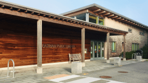
Eastham Public Library
Enter the warming center
One bright spot in all of this are the warming centers. We enjoyed one at the Eastham library. It’s yet another reminder of the wonderful things that a library can do. It meets community needs and is open to everyone,
In the Eastham center, there’s plenty of water, hot coffee, and half & half. Library staff brought in food–green salad, turkey salad, and pizza. There are newspapers and power chargers. A couple are working on jigsaw puzzles. A parent is playing cards with a seven year-old. People see old friends and acquaintances. They learn about weather, road conditions, and specialty health services.
Other warming centers are at churches, the fire department, the high school, and other public places (with generators). Some have cots and blankets.
Section hiking the Appalachian Trail means doing a segment at a time, whenever it’s convenient. It’s not as glamorous as a thru-hike, but it’s still a great way to experience the “footpath for the people.”
Unfortunately, my cancer recovery segments are very short. I may need 21,800 segments to complete the 2,180 miles. That’s going to take a while.
But I’ve accomplished a few already. The photo above was taken two days ago near Great Barrington, MA. The one below is near Becket, MA in January.
We met Stephen on Tuesday and saw his new apartment in Central Park West.
Afterwards, we picked up a half dozen baguettinis at Perfect Picnic, a sandwich place across from the Park. While there, I learned that the owner wasn’t around because she was in Provincetown setting up a branch there.
It’s not authentic old Cape Cod cuisine but is a welcome addition, especially for a good, easy lunch. We ate sitting on a bench along the Hudson River around 100th St.
We’re staying on the barrier spit, Sandy Hook, which is a miniature Cape Cod (3 versus 339 square miles). It’s part of the Gateway National Recreation Area, similar to the Cape’s National Seashore.
There are beach plums aplenty, cedars more than pitch pines, shipwrecks, ospreys, seals, and inviting sandy beaches. There’s even an old military base (Fort Hancock) and an old lighthouse like those on the Cape.
I’ve received the good news that my new book, Thinking with Maps, is now out. I asked to have a copy mailed to Austin so I can pick it up there.
In these locked-up times we miss large gatherings, concerts, dining out, and social visits. Many of us have lost jobs and contact with loved ones. It’s easy to assume that all our social interactions must be through Zoom, our meditations guided by YouTube, and our thinking trapped in endless narratives of the end-of-times.
However, the natural world remains to explore and enjoy. We can still watch the unceasing but ever-changing waves at the beach, walk through forests, listen to birds, check out the bees in the new bee house, and watch adorable rabbits eating our recently planted vegetables. With fewer cars and trucks travelling long distances the air is cleaner and living things are flourishing.
In his book, Confessions, Jean-Jacques Rousseau says, “I can only meditate when I am walking. When I stop, I cease to think; my mind works only with my legs.” Rousseau’s walking was in the woods, not on a treadmill or in a shopping mall. His journeys remind us that our life cannot be separated from the natural world.
Walking in nature can be a social activity as well (six feet apart, of course). Informal connection can be deeper and more attuned to the needs we all feel in these times. We may still feel lost, but we have a chance to find both others and ourselves when we remember our role in nature.
The Trust asked supporters, trustees, and other lovers of nature what particular consolation from nature they are finding during these Covid times. You can see some of the responses in the June 2020 newsletter.
For the 17th year, Wellfleet hosted its State of the Harbor Conference. It was held at the Wellfleet Elementary School on a beautiful, sunny, fall day––Saturday, November 2, 2019.
Participants included ordinary citizens, fishermen, students from K-12 through graduate school, town officials, and staff of the Mass Audubon, the National Park Service, the Center for Coastal Studies, Wellfleet Conservation Trust, and other organizations. They came to report on what they are learning about the ecosystem of the harbor.
There was coffee, snacks, and ample time for informal discussions as well. Americorps workers focusing on the environment helped with the organization, logistics, and even serving Mac’s clam chowder for the lunch.
Q/A with Martha Craig and Kirk Bozma on Herring River restoration
On Sunday, there was a follow-up field trip to look at Wellfleet Harbor’s history and its “black mayonnaise”.
Interactions Within Ecosystems
As was the case in previous years, this was a learning event throughout.
Continuing what’s now a 17-year tradition, the conference showed the complex connections between humans and other living things including phytoplankton, striped bass, menhaden, horseshoe crabs, oysters, quahogs, seals, terrapins, molas (sunfish), phragmites, bacteria, protozoa, resident and migrating birds, as well as the land, sea, and air.
Presenters discussed ideas that went beyond the everyday understanding of harbor ecosystems. These ideas included bioturbation––the disturbance of soil, especially on the sea floor by organisms such as crabs and other invertebrates. There was talk of organism lipid levels as a measure of their nutrient value for predators. One poster emphasized the rise in Mola mola population attributable to increased numbers of jellyfish.
John Brault with Krill Carson’s poster on the Mola explosion
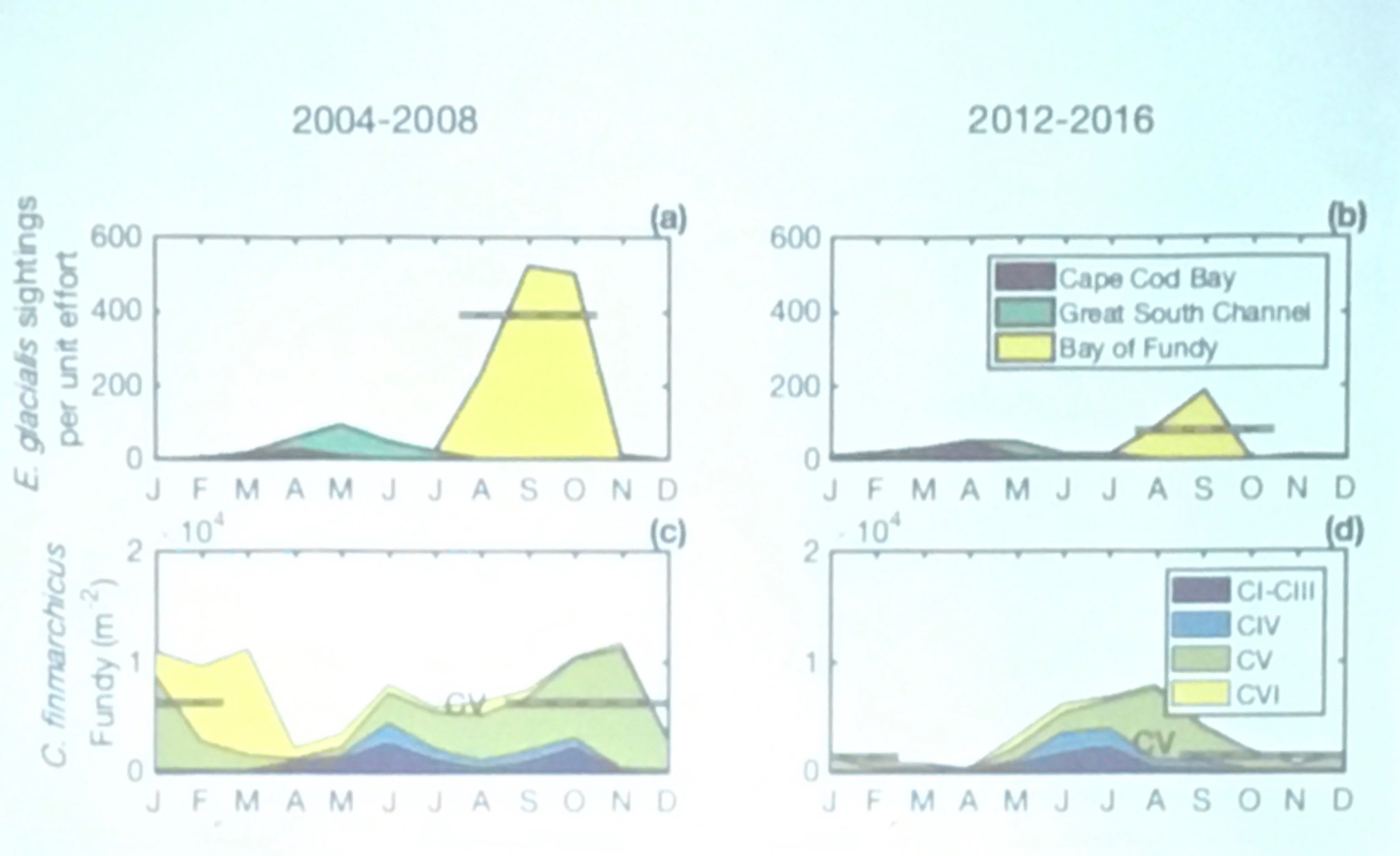
One presentation discussed a major meta-analysis of ocean phenology studies. This research looks at when significant events such as spawning, migration, or molting, occur in an organism’s life cycle. Those times are shifting as a result of global heating, changes in ocean currents and nutrient availability. In some cases there are critical mismatches between the cycle for a predator species and its prey, which has major consequences for both and for the larger ecosystem. A population may increase earlier than in the past, but its food source doesn’t necessarily match up with that.
Correlating sightings of right whales with copepod density
Most notably, the Conference considered the impact of these diverse aspects of nature on people and vice versa. In every presentation or poster, one could see major ways in which human activity affects other aspects of nature.
Civic Intelligence
The Harbor Conference is a good example of how to improve what Doug Schuler calls civic intelligence, becoming more aware of the resources in our community, learning of its problems, finding ways to work together, and developing civic responsibility.
In any locality, civic intelligence is inseparable from the nature all around. But in Wellfleet this connection is more evident than in most. Every issue––transportation, affordable housing, employment, health care, fishing and shellfishing, waste management, history, and more––affects and is affected by our capacity to live sustainably. The harbor and the surrounding ocean, rivers, and uplands are deeply embedded with that.
There is a depressing theme through much of the Conference. The studies reported in detail on the many ways that humans damage the beautiful world we inhabit, through greenhouse gas emissions causing global heating and higher acidity, increased storm activity, and sea level rise. There is pollution of many kinds, black mayonnaise, and habitat destruction.
Mark Faherty offered a promising note for the horseshoe crab population. But even it has a downside: As the whelk population falls there will be less call on horseshoe crabs as bait, so that may help their recovery.
Nevertheless, it is inspiring to see the dedication of people trying to preserve what we can, and to learn so much about the ecology of the unique region of Wellfleet Harbor.
Maps for Learning
A striking feature of every presentation and poster was the use of maps. These included maps showing tidal flows, migration patterns, seasonal variations, sediment accumulation, human-made structures, and much more.
Maps of process and monitoring
If we extend the idea of maps to visual displays of information, then it evident that even more maps were used. These included flowcharts for processes such as the one for adaptive management shown above, organization charts, and timelines for events in temporal sequences.
1887 Map of Wellfleet
The maps are not only for communication of results. They are also a useful tool for the research itself. The most useful applications involved overlays of maps or comparisons of maps from different situations or times.
As an example, the population of horseshoe crabs could be compared with the management practices in a given area. Is the harvest restricted to avoiding the days around the new and full moon? Can they be harvested for medical purposes? For bait? The impact of different regulatory practices across time and place could easily be seen in graphical displays.
The Conference as a Site for Learning
You would find similar activities at many conferences. But the Harbor Conference stands out in terms of the cross-professional dialogue, the collaborative spirit among presenters and audience, and the ways that knowledge creation is so integrated with daily experience and action in the world.
This learning is not in a school or a university; there are no grades or certificates of completion. There are no “teachers” or “students” per se. However, by engaging with nature along with our fellow community members, conference attendees explore disciplines of history, statistics, politics, commerce, geology, biology, physics, chemistry, meteorology, oceanography, and more.
Nature itself is the curriculum guide. It is also the ultimate examiner.
[Note: This text will be cross-posted on the Wellfleet Conservation Trust blog.]
Our excellent guide, Suman, with doongas, on the Rapti River
Ordinarily, I’d like to share beautiful photos, or at least ones that convey useful information, such as a title sign. But today you’ll see some of my worst.
We were on a doonga (canoe)/walking safari in Chitwan National Park. For this trip, we floated down the Rapti River for about 2.5 miles, then walked through the jungle for another 5-6 miles.
Elephants passing by
In the beginning of the doonga portion we saw unusual birds, elephants, lush tropical vegetation, and along the banks, the occasional crocodile, namely, the marsh mugger (Crocodylus palustris), or crocodile of the marsh. They’re listed as threatened–vulnerable, so we were careful not to disturb them.
Gharials at the conservation center
We felt fortunate to see majestic creatures whose ancestors appeared 200 million years ago in the Triassic, and which can grow to 10 feet or more long. The area also provides a home for the critical-endangered gharials, or fish-eating crocodiles. We didn’t expect to see them in the wild, but did see many at the crocodile breeding center.
Mugger under water
But there was a moment when I lost all interest in the marsh mugger’s conservation status. One large one approached our doonga, possibly touching it. His shoulders and front legs were next to Susan’s seat; his impressive mouth was next to mine.
Mugger next to doonga
I knew not to trail my fingers in the water, but there would have been little defense against his attempting to overturn the canoe. As we had eight tasty people on board, and there were probably several other muggers nearby, that could have been disastrous.
Raju, with trusty stick
I tried to get a photo, but being generally inept and only now trying out a smart phone, I mostly managed to get photos of my palm and the sky. I won’t impose those on you, but I will share a couple that do show the crocodile.
On the trail
The most important photo shows the stick that our guide, Raju, used to bang on the head of the mugger to discourage it. Later, we learned that this was not a normal event, nor an exciting treat for the tourist, but a real emergency. The story went around Sapana Village, and Raju was a deserved hero.
On the trail (2)
Next to dormant termite mound
Mugger along the trail, apparently dead, but very much alive
I had a delightful day at the Central Zoo inJawalakhel. Despite some problems, the zoo is popular with families. The Friends of Zoo collaborates with 200 schools in Kathmandu Valley. The zoo is working on better enclosures with improved habitats for animals and there’s a recently established Animal Hospital.
I saw one obviously Western couple leaving as I arrived. Otherwise I didn’t notice any Westerners in a visit of well over two hours. They’re missing out.
Posing at the fountain
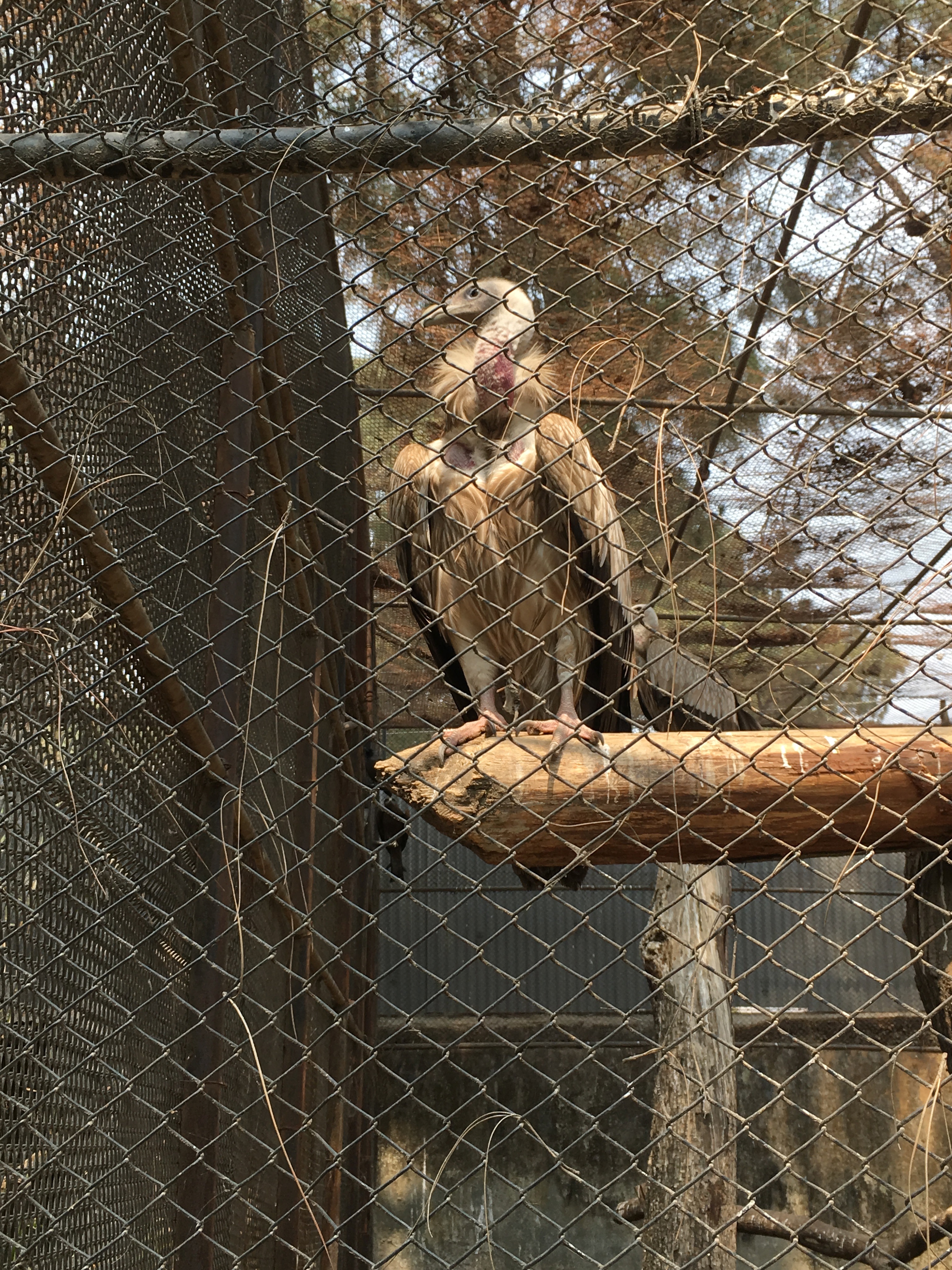
Himalayan griffon
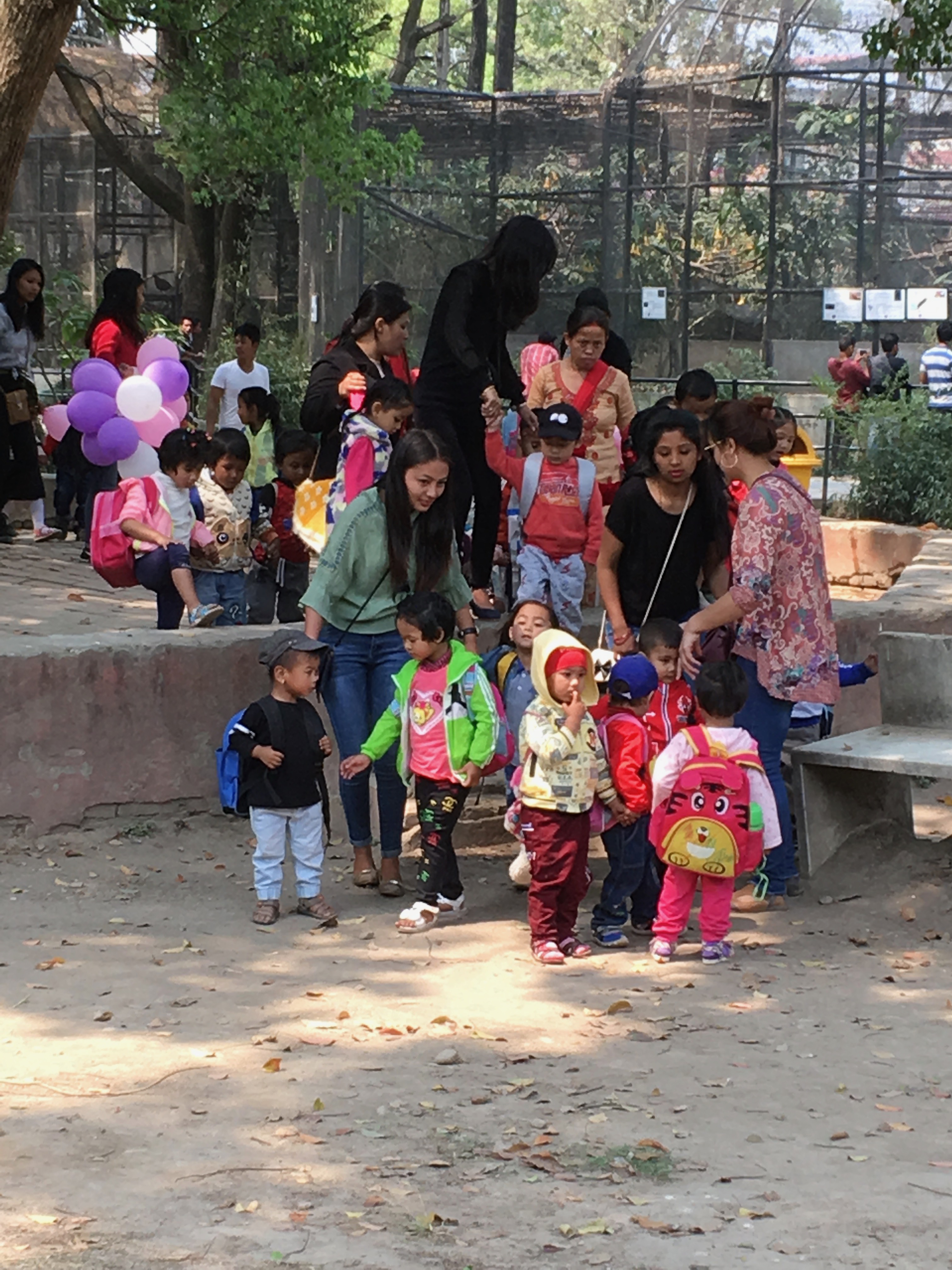
As much as I’ve enjoyed seeing the multi-starred sites like Patan Durbar Square, there’s nothing like a visit to the zoo for seeing Nepali families enjoying life together in a relaxed fashion. There’s photo taking (both ways) and ample opportunities for casual chats. This gives me a much better sense of the country than seeing some impressive monument.
People watching
As with any zoo, there’s a clear priority on what to see: Plants and physical layout, yes; animals even more; and people best of all. Girls and women were often in beautiful saris and other costumes, perhaps in part because of the holiday (Rama Navami, a spring Hindu festival). Boys and men, including me, were in the obligatory, international male costume of t-shirt and jeans, or other rough pants.
Boating on the central pond
There were groups of pre-school age children, fathers with children, nature lovers, teenagers, old people, visitors from mountain villages, romantic couples, and many more.
Biodiversity
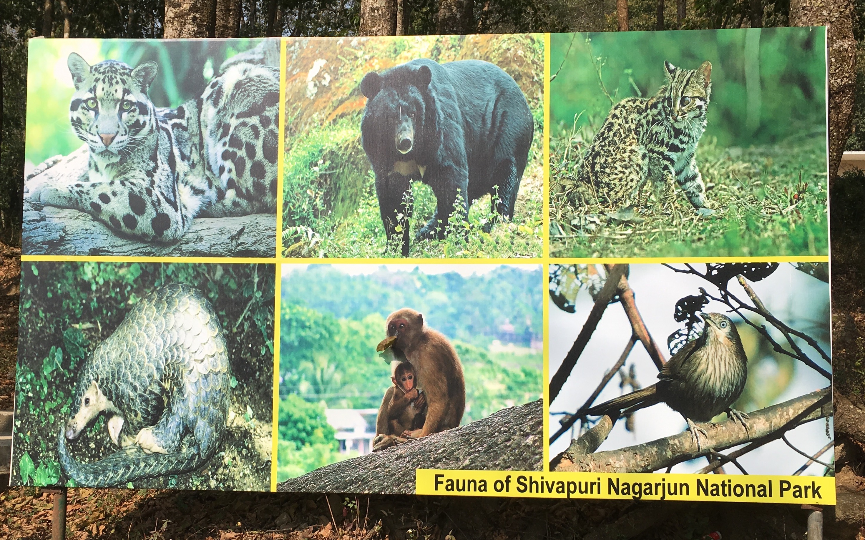
Nepal has remarkable changes in elevation and associated variation in eco-climatic conditions. It lies between the tropical Indomalaya ecozone and the temperate Palearctic ecozone. A total of 118 different ecosystems have been identified. All of this leads to Nepal being a biodiversity hotspot, albeit one under severe threats as with biodiversity everywhere on the planet.
Getting organized
Among the notable mammals in Nepal are pangolins, Bengal tiger, one horned rhinoceros, Asiatic elephant, red panda, snow leopard, and Tibetan wolf. There are many reptiles unique to Nepal and over 900 bird species. The Himalayan griffon vulture is is the largest and heaviest bird found in the Himalayas. There are also many unusual fish, invertebrates, and plant life. The red rhododendron grows throughout Nepal and is a national symbol. The zoo houses many of these creatures and seeks to expand its collection, especially of indigenous fauna.
Management
Red panda
The zoo has problems related to space, budget, training, and animal care. It reminds me of some zoos I visited when growing up in the US, before funding improved and international zoo standards were enforced. However, after 1995, the National Trust for Nature Conservation took over the zoo and has initiated projects to make it a fully modern zoo, with natural habitats, and facilities for education and research. It’s already become a refuge for live animals being smuggled internationally.
A pigeon, the best animal at the zoo
Comparing to the Lincoln Park Zoo in Chicago illustrates the challenge for the Central Zoo. It has half the acreage and about 3% of the budget. Even considering purchasing power parity it’s trying to do a lot with little.
Juddha Sumsher J.B. Rana created the zoo in 1932 as a private trophy. He was maharaja and ruled Nepal as head of the Rana dynasty. This explains the two incongruous statues of women standing in prominent positions. One is of his mother and the other of his sister-in-law. The zoo opened to the public in 1956 under various managements. It’s called the “Central Zoo,” even though it’s the only one in Nepal.
I recently “climbed” Shivapuri. I have to put that in quotes, because for Nepalis and serious trekkers, this is a “short and easy walk.” For this flatlander, however, it was a serious climb.
Most of the guides describe it as 3-4 hours up and 2-3 down, with extra time needed for photos, lunch, shrine visits, and such. So, it consumes much of one day. My fitbit got a workout, reporting 38,000 steps and 353 flights of stairs. To be fair to flatlanders, it’s not a negligible height–8,963 ft, easily higher than anything east of the Rockies in North America.
I learned that Mira Rai had been there the day before my walk, hosting a trail running event. The distances were 25 K, 50 K, and 80 K. I could still see many of the brightly colored ribbons marking the trails for the races. Perhaps you need to walk there to understand why an 80 K (50 mile) run up and down the hills would be a good workout. One man ran directly up and down to Shivapuri peak in one and a quarter hours. That’s a good marathon pace by itself, but on stairs at altitude it’s unbelievable.
Nagi Gomba
Sights
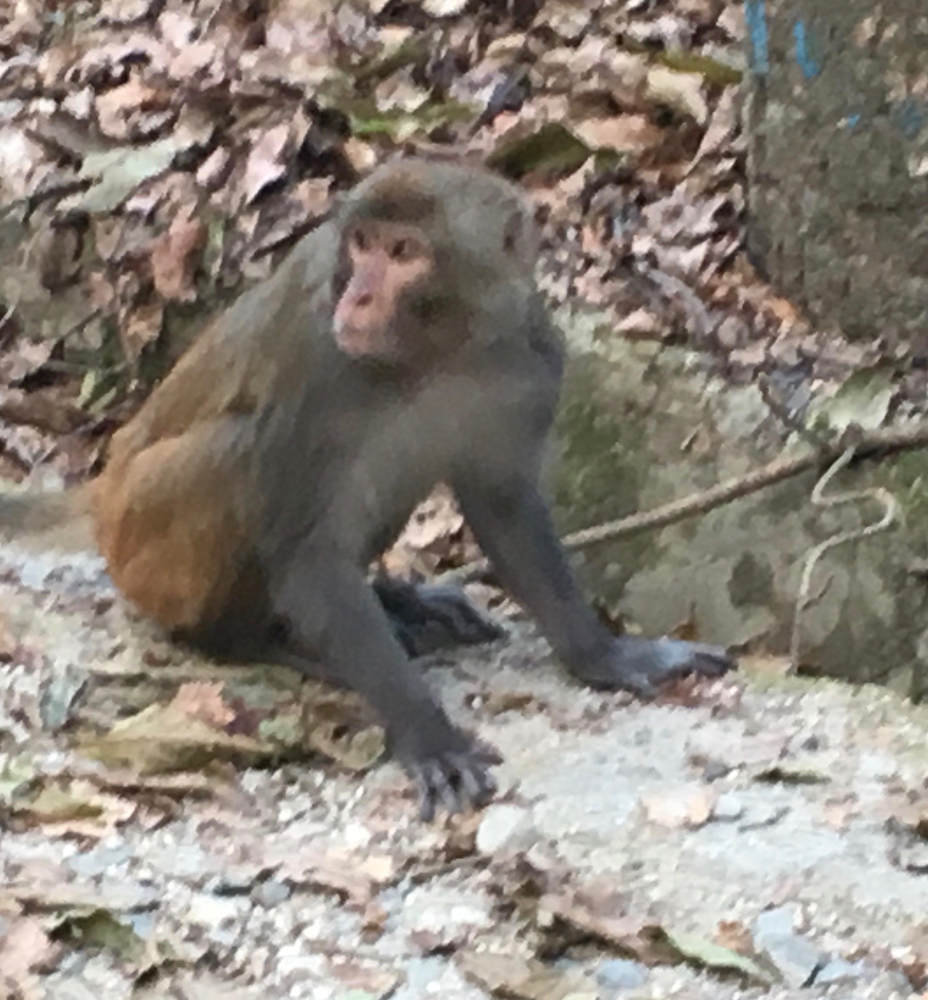
At my more sensible pace, I had a chance to observe more of the natural beauty of Shivapuri. Starting at the Pani Muhan gate, I saw Asami monkeys, a type different from the rhesus monkeys one sees around temples in Kathmandu. There were loud calls from the many warblers in the park, as well as from blue magpies, Bonelli’s eagles, and great Himalayan barbets. I mostly just heard these, but did see kalij pheasants. Beautiful butterflies were everywhere, and mercifully, no annoying insects.
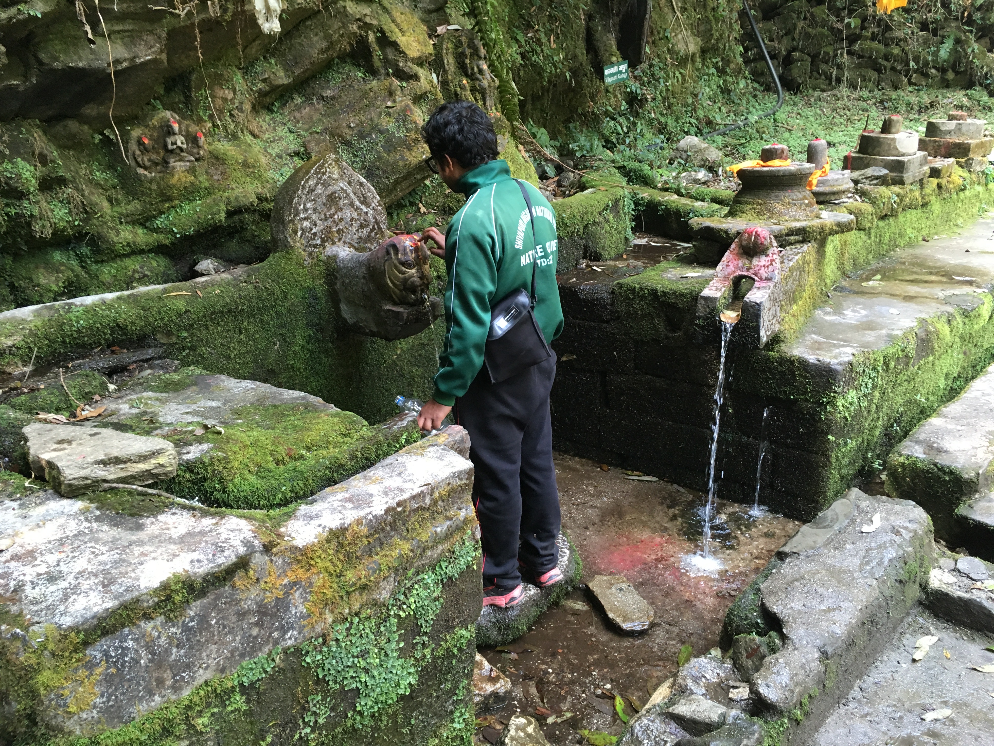
Water source and temple
There are some magnificent pines at the lower elevation, then a dense forest of laurels, rhododendrons, and oaks heading up.
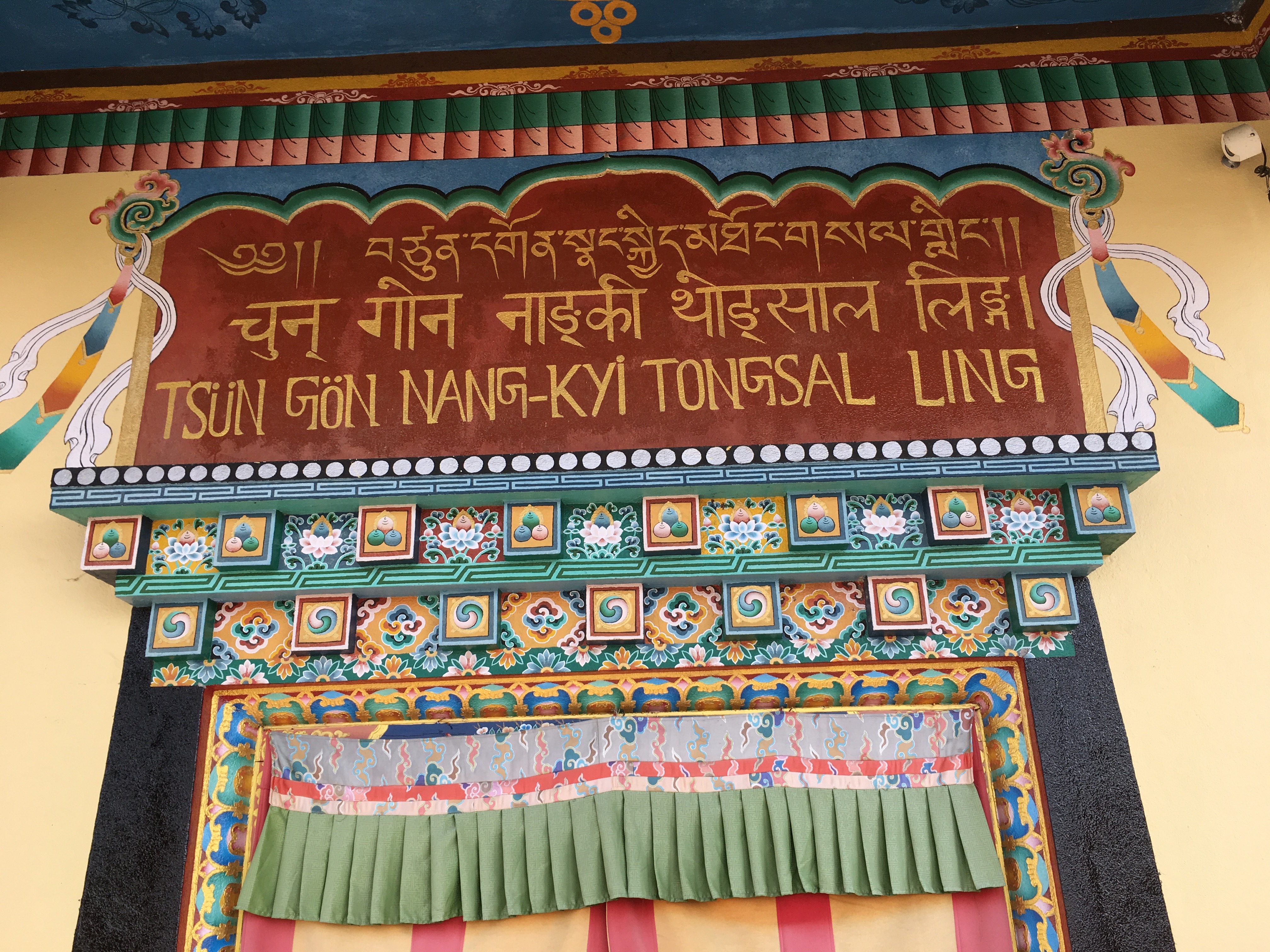
The first major stop is Nagi Gomba, a Buddhist monastery run by nuns. There’s a school for orphans. Although there is still much evidence of earthquake damage, fortunately, not al of the buildings were destroyed. You can also fill up your water bottle with clean mountain water. The photo of the main doorway shows the title in a Tibetan language, in Nepali, and in Tibetan with Roman script.
Signpost
My guide
There are mostly helpful signposts marking the way. But they’re not necessary because of the mandatory guide. In one of the photos you can see Badi filling up his water bottle at a shrine. There, he also applied a tilak, along with the prayer – “May I remember the Lord. May this pious feeling pervade all my activities. May I be righteous in my deeds.”
At Shivapuri peak
Badi, by the way, was an excellent guide, helping to identify many of the unfamiliar natural phenomena. He was also very honest. When I said, “I need to get in better shape,” he replied, “yes, you do.” Seeking a little softer response, I added, “I need to lose some of this belly.” Perhaps I hoped he’d say that I wasn’t that bad for an old man, but instead, I got another, “yes, you do.”
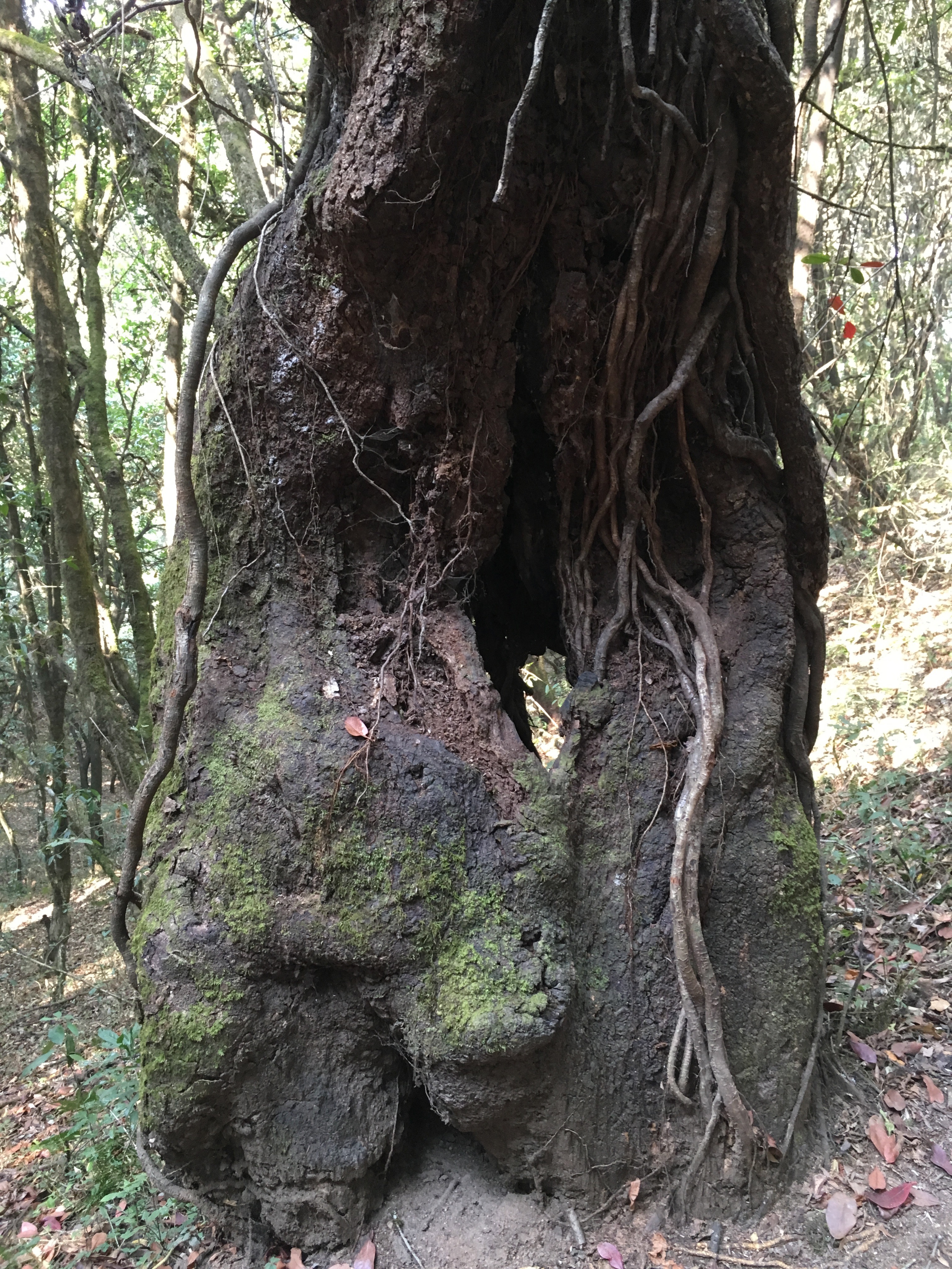
Huge, old oaks
So, I asked whether he’d guided anyone as old as I on this “climb.” He told me about a 65 year old German man. He was a pilot who had a terrible crash, breaking many bones. His doctor told him to take up walking and trekking. I knew what was coming: “He was in much better shape than you.”
The top
I struggled a bit near the top. I was probably dehydrated, getting a little dizzy. At one point the mica on the ground and in the rocks presented me with a beautiful kaleidoscope of flashing lights. I enjoyed that for a moment, until I remembered that I needed to be paying attention to the walking.
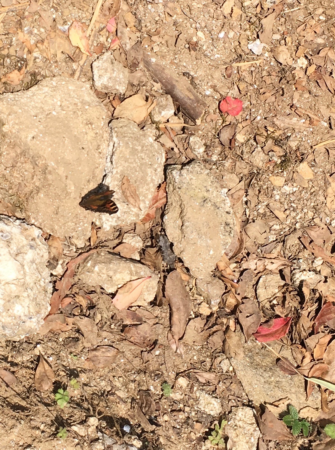
Many beautiful butterflies
We managed to reach the summit and paused for a brief lunch. Unfortunately, there was cloud cover, so we didn’t get the view of the Himalayas that many people count on as their reward for the climb.
Also, I felt a little sick, which may have had something to do with the mica kaleidoscope. So I walked back down a short way to take care of business in the woods. When I came back up to the peak, I realized that I had technically ascended it twice in one day, something few people do. My pace was glacial and my form was embarrassing, but I made it, and twice!
I had a wonderful day at the National Botanical Garden, about half an hour by motorized transport south of Patan, in Godawari. It lies below Mt. Phulchwoki (2715m), which is the highest peak in the Kathmandu valley. It’s an instant relief to be in a quieter place with cleaner air. Beyond that, the garden is a pleasant place to walk with many interesting specimens and layouts.
Some of the grounds are relatively wild and undeveloped, but most are organized into special gardens, such as a typical Nepali terrace garden, with a Nepali style stone tap at the top, a water garden, a fern garden, a Japanese garden, a rock garden, a lily garden, and a Conservation and Educational garden for students and scholars.
Posing for photos in the Japanese garden
A heavy load of greens
Family playing along the creek
Egret in the terrace area
School groups
Flowers and goats in the distance
The entry complex, with a pleasant, informal restaurant
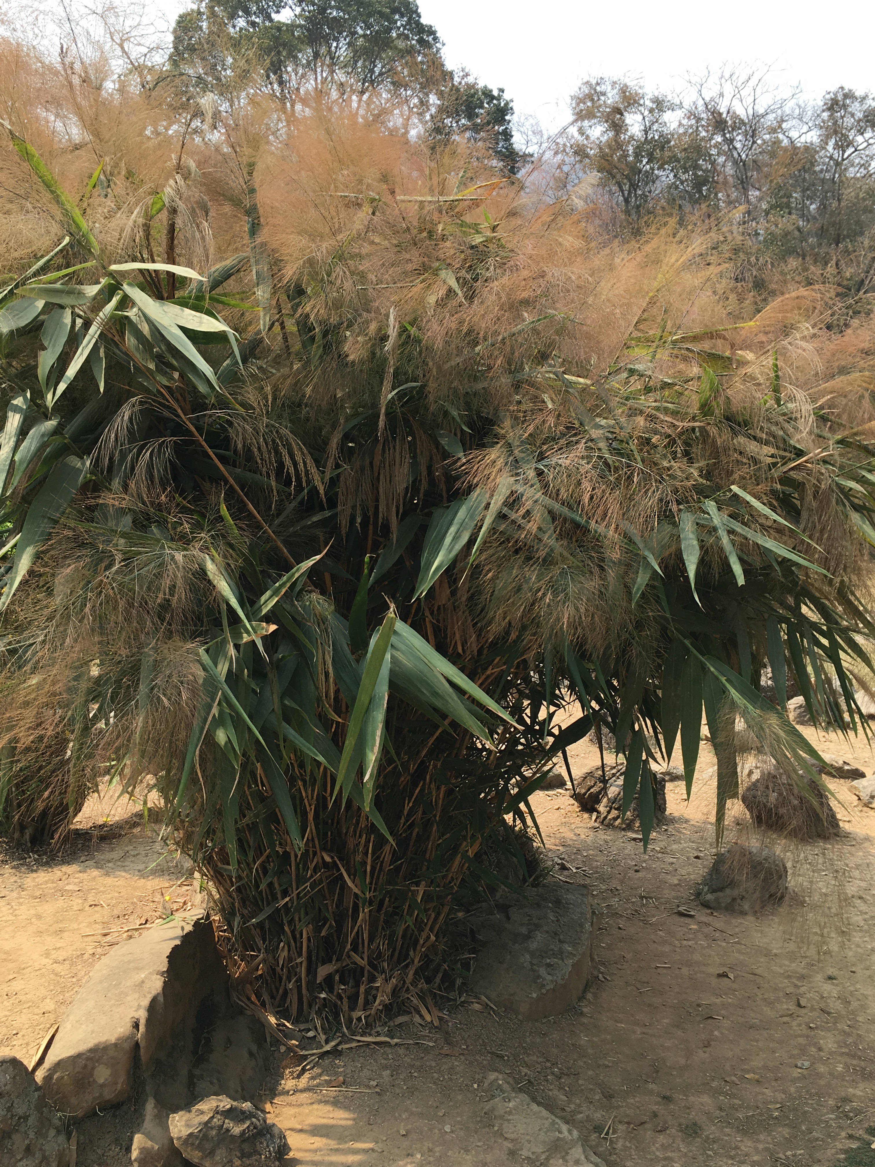
Nepalese broom grass (Thysanolaena); flowers used to make brooms