Time travel in west Texas

p1080726

Sunrise out of the cabin

Ever since reading The Time Machine as a teenager, I, like most people, have wondered about time travel. And despite annoying naysaying from logicians and physicists, it still seems like an intriguing idea.

Wolf spider

Wolf spider

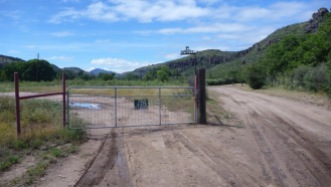
Susan and I just spent a week in far west Texas, where we experienced something like time travel. We stayed in a cabin in a caldera near Fort Davis. Other than a barbed wire fence, a single electric line, and a narrow, rutted dirt road there were no signs of human habitation––no other buildings, no cell service, no flights overhead.

An astute rancher might have pointed out that the male cattle were steers, not bulls, and that the cattle and many turkeys around were probably being raised for market. Closer inspection would reveal that there were some planted trees, both for shade and for pecans, but on the whole the impression was of desert isolation.

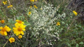
In this land the people are hard to find, but we could see yucca, sotol, ocotillo, prickly pear, sagebrush, mesquite, live oak, and uncountable wildflowers. We saw buzzards, mockingbirds, huge spiders, whitetail and mule deer. These living friends were framed by gorgeous sunrises and sunsets, and unbelievable cloud formations.

(Reconstructed) Fort Davis from 1854

1854 Fort Davis (reconstructed)

This all made me think of my early days in Fort Worth. We lived then in the new suburbs on the edge of ranchland. In our childhood explorations we could find tarantulas and horned toads, tumbleweeds and cockleburs, scorpions and butterflies. The land seemed to stretch forever into remoteness and romance. When we looked up we could see the Milky Way and thousands of stars.

Fort Davis felt like that Fort Worth of long ago. The contentious Presidential race was irrelevant. The old cashier at the local market wanted to share interesting stories rather than to ring up grocery items. The buildings and houses looked like stage props for an old Western, until you realized that they were still in use, probably by the same family that settled here a century or two ago.

Rhyolite porphyry in fantastic shapes from volcanoes 35 million years ago

Rhyolite porphyry in fantastic shapes from volcanoes 35 million years ago

Fort Davis itself lies at the base of a rhyolite cliff, the south side of the caldera, or box canyon, that held our cabin. With just a few steps we could reach the path to climb the cliff shown above. Without realizing it, we zoomed even further back in time, to an era of intense volcanic activity, which created the Davis Mountains. The rhyolite columns, tuff and pumice, volcanic peaks and domes, took us entirely away from the human world.

The Hobby-Eberly Telescope at the UT McDonald Observatory

The Hobby-Eberly Telescope at the UT McDonald Observatory (from mcdonaldobservatory.org)

But not long after that we learned what time travel could really be. We went to the nearby University of Texas McDonald Observatory, which takes advantage of the clear mountain air.

Among many projects at McDonald is the Hobby-Eberly Telescope Dark Energy Experiment (HETDEX). This seeks to uncover the secrets of dark energy, using the large Hobby-Eberly Telescope and to survey the sky 10x faster than other facilities can do. It will eventually create the largest map of the Universe ever, with over a million galaxies. In doing so, HETDEX will look back in time 10 billion years.

If there is anything more amazing than the mind-stretching that Fort Davis does, it is that the area is so little visited. In addition to the sites mentioned above, there is a state park with numerous hiking trails, the Chihuahuan Desert Nature Center and Botanical Gardens, interesting towns such as Alpine and Marfa, and the world’s largest spring-fed swimming pool, under the trees at Balmorhea State Park, which takes one back to the wonderful CCC projects of the 1930s.


Walk to Ptown

Ever since moving to the Cape, I’ve wanted to walk to Provincetown. It wasn’t because of the Wampanoag people, or other early explorers and settlers who wrote about the area, such as Gosnold, Champlain, the Pilgrims, or Thoreau. It was simply that I wanted to connect with the land and sea in a way that walking does, more than riding in a car or bus, or even on a bicycle.

Yesterday, Emily, Stephen, and I managed to do it–what turned out to be 35,000 of my steps.

We walked out the front door, down the hill to Wellfleet center, across route 6, past the ponds of Herring, Williams, Higgins, Slough, Horse Leach, and Round. Then we split up, with Stephen taking the beach walk along the Cape’s backside while Emily and managed the brambles on the dune ridge. We met up again at Ballston Beach, where Emily took a break, having carried the pack the entire way. Stephen and I continued on the beach past Long Neck Beach to a spot between the abandoned North Truro Air Force station and Highland Light. At that point we turned west to cross the Cape to the Bay side. From there it was a straight shot north to Provincetown, where we met up with Emily and Susan and had a lovely early dinner.

This slideshow requires JavaScript.

Sharing science across generations

In my last post I talked about an intergenerational reading experience. The day after that occurred, I had an intergenerational science experience when I attended the 12th Annual State of Wellfleet Harbor Conference.

The Harbor conference is always interesting, moving smoothly between very local issues in Wellfleet Harbor to regional issues in Cape Cod and New England, and on to global issues, especially those related to human activity, such as global warming, sea level rise, pollution, and decreasing biodiversity.

The presentations and posters dealt with a wide variety of topics: river herring spawning migration, including transponder tracking, training robots to assess landscape change in the Herring River floodplain, shellfish for nitrogen mitigation, horseshoe crab conservation, modeling sea level rise and vegetation change, ocean sunfish strandings, eel monitoring, restoring the Mayo Creek salt marshes, diamondback terrapin nesting, among others.

Although the sessions were diverse, there was a common theme of restoration, going from “How can we assess the damage?” to “How bad will it get?” to “Is there anything that can be done?” It was depressing to see the many ways that we’ve destroyed a beautiful habitat, even one that is supposedly protected by the National Seashore. On the other hand the efforts at restoration are impressive and may at least provide information about what not to do in the future. There was discussion of plans to restore Herring River and Mayo Creek, salt marshes, and many individual species of sea life. If these restoration projects are to succeed they need to involve a large public of all ages, not just a few scientists.

The conference was a delight to attend, even more so since most of the topics related to areas easily accessible by walking or paddling from our home. For example, we’ve seen the amazing ocean sunfish stranded on Mayo Beach only ten walking minutes from home and friends have encountered live ones while kayaking just offshore.

Aside from presenting an opportunity to learn about many topics, the conference was another good example of an intergenerational experience. Presenters included college students and volunteers of all ages. The audience was diverse as well, with some who remember well times long before the National Seashore was created.

One of the presentations was by Nauset Regional High about their own research in collaboration with the Wellfleet and Truro fifth grades. It was the first time to have K-12 presenters at the conference. The students wanted to compare oyster growth and mortality in Herring River and Mayo Creek. An interesting question for their study is that the streams experience tidal variation and high salinity at their outlets, but vary to mostly fresh water higher up: Would oysters be able to survive and thrive away from the sea? Each group of students measured and marked a set of ten oysters. There were five bags for different locations on the Herring River and three for Mayo Creek. The young scientists left each bag with oysters for six weeks, then collected it and re-measured the oysters.

The students learned some of the challenges of field science. For example, one of the oyster bags was missing when they went back to collect it. Valerie Bell, the environmental science teacher at the high school, asked the audience almost as a joke, “if you come across a bag like this can you give us a call?” To my amazement, someone in the back called out that they had in fact found the bag. It must have broken from its mooring and floated with the tide to another location. It was a small thing, but a nice example of community science in action.

Walker trail

Map of WCT lands

Map of WCT lands

Wellfleet Conservation Trust logo

Wellfleet Conservation Trust logo

The Wellfleet Conservation Trust has been very active recently, securing land for conservation, guiding walks, and building trails for anyone to enjoy. Their website gives a good idea of their many projects. As you can see from the map on that site, the WCT land complements that of several other organizations, making a wide variety of environments available for protection of plant and animal life and preservation of the fragile land, as well as helping the people have healthier lives in every sense of that word.

Walker trail pond

Walker trail pond

I was fortunate to get to assist with some of the trail clearing, including at the recently established Walker trail. The site is nearby, one that we can visit on the way to swim in local ponds or after a trip to the transfer station.

The trail minus foliage

The trail minus foliage

The trail runs through land donated by the Walker family. It’s short, but surprisingly varied, with some ups and downs, views of a few houses, and a small pond. Making the trail included installing some benches and rustic steps for the steeper portions. There was also a major project to remove a large dead branch that was hanging over the trail. Members of the WCT, young workers from the two Wellfleet residences for the AmeriCorps Cape Cod program, and other volunteers all contributed to the effort.

Hung branches

Hung branches

The WCT mission is “to assist and promote the preservation of open spaces and natural resources and to protect the rural character of the town of Wellfleet…The Trust acquires land by gift or purchase…develops walking trails and encourages the study and implementation of sound environmental practices.”

Start of trail

Start of trail

Click on any of the photos to enlarge them.

WCT bench

WCT bench

Log steps

Log steps

Citizen Science in Wellfleet

Herring River estuary

Herring River estuary

The current habitat for communication between science and the public is dysfunctional. One need only look at the “debates” about climate change or disease prevention to see the problem.

Scientific findings are regularly misrepresented and sensationalized in the mass and social media. Even when well presented, those findings are ignored or distorted, attacked through faulty arguments, or tied to unsupported inferences. At its best, current science/public dialogue tends to be one-way, with the occasional enlightening article, book, or video, followed by public commentary. This rarely serves to deepen  understanding, much less lead to enhanced inquiry.

State of Wellfleet Harbor Conference 

Wellfleet marina

Wellfleet marina, note osprey nest, upper left

The 10th Annual State of Wellfleet Harbor Conference held yesterday at the Wellfleet Elementary School represents an alternative to that typical dysfunctional science/public relationship. One refreshing note was an effort by scientists to explain not only the results, but also the assumptions, methods, and theories behind them. People asked about the selection of factors to study, or about habitat assessment in tidal river versus bay sites, not to discredit a finding, but to understand more about how results were achieved. The conference was itself a small data point for the case that ordinary citizens can engage in science-based discussions, given enough time and well-crafted presentations, displays, videos, and other materials.

Poster session

Poster session

You can see from the schedule that there was a wide variety of presentations and posters. There was talk about dolphin mass strandings, bathymetry, auditory evoked potential, sentinel species, estuaries, cross-shore sediment transport, salt marsh backup, turtle gardens, terrapin clutches, brumation, eutrophication, cultching, winter/spring blooms, quahog seed, anoxic shellfish, temperature-dependent sex determination, anthropogenic effects, and many other topics related to the diverse ecosystems of the Outer Cape.

There were some good videos from the Friends of Herring River and the International Fund for Animal Welfare (IFAW). Brian Sharp complemented the latter with a talk and a tour of the IFAW van used for marine mammal rescues. This was especially salient given the mass strandings of dolphins in Wellfleet Bay in the early part of the year.

Mayo Beach, with groin

Mayo Beach, with groin

These presentations emphasized the interconnectedness of ecosystems, with humans as an integral part. Mark Borrelli from the Provincetown Center for Coastal Studies talked about how groins and revetments prevent local beach erosion, e.g., to protect a house, but shift the erosion elsewhere. Thus, they are simply “erosion relocation structures.” Sarah Martinez from the Mass Audubon Wellfleet Bay Wildlife Sanctuary presented a poster on the consequences for horseshoe crabs of their use as bait for conch and eels. Moreover, the revetments that relocate beach erosion also disturb the spawning, much of which occurs above the high tide mark.Vincent Malkoski from the Massachusetts Division of Marine Fisheries spoke about the data on horseshoe crab fisheries. These findings have led to harvesting closures for five days around the new and full moons in May and June to allow lunar spawning. Diane Murphy from the Cape Cod Cooperative Extension and Woods Hole Sea Grant spoke on the relation between oyster and clam growth and the wide variety of habitats they find in Cape Cod Bay.

Avoiding Either/Or Thinking 

Fishing boats

Fishing boats

One consequence of creating the forum in this way was that discussions avoided the either/or kind of thinking often expressed in mainstream media. For example, although most of the participants shared deep commitments to preserving natural environments and generally opposed rampant development, I heard statements such as “you can’t say that dredging is always bad or good; the decision is about choices and values.” There would then be productive dialogue that critiqued human-made alterations of the shoreline, estuaries, ponds, and so on, but acknowledged values others might hold for commerce, recreation, or housing. Zero-based planning  is no longer an option in the Wellfleet area: Every change today, even one that seeks to undo earlier construction, interacts with a myriad of alterations over centuries and can have unintended consequences for the environment.

Interactive map

Interactive map

Multilogue

Through Q/A, posters, and ample time for informal discussion, the conference fostered one to many, many to one, and many to many conversations among participants including scientists in the same and other disciplines, students, and general public. There was an interactive map on which people could write their hopes and concerns and peg them to a geographic spot. The map activity will be continued at the library to solicit input from those who did not attend the conference. I saw numerous examples of scientists taking seriously the concerns or knowledge of the public.

This was perhaps enhanced by the fact that many of the projects involve direct citizen science participation , e.g., the river herring count, the horseshoe crab spawning assessment, terrapin sightings, and the dolphin rescues. Others involve coordination with local activist organizations, such as the Wellfleet Conservation Trust.

Some were of special relevance to those involved in commerce, such as oyster farmers. Jessica Smith and Barbara Brennessel from Wheaton College had an interesting poster on a study of genetic diversity among hatchery versus reef oysters, showing, as one might expect, a greater diversity for the reef oysters. This provides indirect support for seeding oyster beds with pelagic, rather than hatchery, veligers. Some oyster farmers still collect these wild larvae for seeing their beds, despite the method being considered slower, difficult, and old-fashioned. A quahog farmer of 30 years was able to add comments about changes over three decades that was missing from most of the shorter-term scientific studies.

Sustainability

IFAW van

IFAW van

Perhaps a meeting like this requires a supportive habitat such as Wellfleet in order to thrive, just as the terrapins, horseshoe crabs, eels, dolphins, ospreys, and other creatures do. Would it fail to survive elsewhere?

Richard Lewontin points out in The Triple Helix that no organism can survive without a supportive environment, but also that no living environment exists without organisms. In this case, the conference organism succeeds because of the town environment, but also shapes it to become more supportive of exactly the kind of discussion heard today.

The conference was well-organized with good snacks, including clam chowder. I came away with a renewed appreciation for the special beauty of Wellfleet, but also sadness about what we’ve done to destroy this, and so much else of the natural world. The fact that a conference such as this is so rare punctuates that sadness. How much did you hear from political candidates or mass media this year about protecting the environment we all live in and depend upon?

Small but good things are worth preserving. I hope to make the conference an annual event.

Almost counting herring

Black Pond, Wellfleet

Black Pond, Wellfleet

Because of the warm winter on Cape Cod this winter, the alewives are returning early to the local rivers. Alewives are a type of herring. They’re anadromous, meaning that they live in the ocean, but swim up freshwater streams to spawn.

Their population is declining in New England, so the River Herring Network organizes herring wardens and volunteers (called “monitors”) to assess their numbers during the spring run. The counts go on for two months, with volunteers assigned specific times each week to count.

field test kit

field test kit

Locally, the count is connected with efforts by the Friends of Herring River to restore that river to something akin to its condition before the Chequessett Neck Road Dike was installed and the surrounding wetlands were developed.

Susan got the official training for the count, so she’s the real Monitor, but I went along as a volunteer for the volunteer. I guess you could say that I was an Unofficial Herring River Estuary Alewife Monitor Assistant (UHREAMA).

water temperature

water temperature

We decided to cycle to the site for our first scheduled count. It’s only a half hour away, but has some good hills and soft sand paths to make the cycling interesting. We passed Black Pond and a friend’s house on the way. You can these and other photos at photos from the count.

The official count site is at a beautiful bend in the tiny Herring River, with a fallen willow marking the spot and serving as a convenient shelf for the field test kit. Byu the way, there are many Herring Rivers. This is the one in Wellfleet.

Here’s the data for our first foray:

  • Time: 9:07- 9:17 am
  • Air temperature 12 ºC
  • Water temperature: 13 ºC

Unfortunately, the number that matters most is this one:

  • Number of herring: 0

Somewhere else, this bridge over the Herring River would be seen as in need of a little repair, but here, it’s just a reminder of the alliance between culture and nature in the National Seashore area. That alliance isn’t without its problems, as we can see in the decline of the Herring River and its herring, but at least there’s an effort to try to make it work.

Art scene in Sandima

We went to the (almost) abandoned village of Sandima yesterday.

The story is that it was wiped out three times: once many centuries ago by the bubonic plague, when many residents died and the village had to move; again by the citrus industry, which lured away the young people to work in the orange groves closer to Yalikavak; and a third time, by rampant development, which has covered hillsides with white block houses for people seeking the Mediterranean sun and lifestyle.

The village is just up the hill from Yalikavak. It looks like an old war zone, with abandoned homes, stone walls, watering stations, and a mosque, all now becoming overgrown with vines and scrub vegetation. There are two schools, an older, religious school, next to the mosque, and a newer one with four rooms. The latter looks as if it must have been an attractive site for learning at one time, but now is missing doors, has large holes in the floor, and is covered with graffiti.

It’s possible to follow old footpaths and to go into the buildings, which are not much more than piles of rubble, everything of value having been removed. There’s a second abandoned village just across a ravine.

There are only three residents in Sandima today. One is an 86-year-old man who refused to leave. His story is that he walks into Yalikavak every day, not for work or food, he has his garden and cows in Sandima, but to look for a mate.

There are also two artists, Ismail Erkoca and Nurten Değirmenci. Ismail gave us a tour of their house, which is the most decorated one I’ve ever seen. Every surface, including floor and ceiling, was covered with art works, or just painted, or festooned with bougainvillea, lantana, hibiscus, and other flowers. Navigating the nooks and crannies, bridges, and hidden passageways required a guide. It soon became clear that if selling artwork were not a business, then giving tours of the house could become one.

The house is called Nuris Sanat Evi, Nur from Nurten and Is from Ismail. Sanat Evi means art house. The story of the name (we heard many stories) is that Nur means holy light and Is means black soot from a fire. So, one needs light to see the darkness.

We enjoyed the adventure of talking with Ismail and getting a glimpse of his life, one far removed from İstanbul, where he was born.

I was pleased to learn more about the Köy Enstitüleri (Village Institutes) from Ismail. I wonder whether the newer school in Sandima was created following John Dewey’s report or somewhat later as a result of the institutes? I’ll save thoughts on that for a future post.

Tracking the Oil Spill

The New York Times has some interesting interactive graphics and multimedia on the oil spill in the Gulf, e.g., Map and Estimates of Oil Spilled in the Gulf of Mexico. Be sure to use the “Play” button to see how the spill has developed between April 22 and today.

The story of how this has happened and the ongoing saga have much more impact than figures about “millions of gallons,” especially when estimates vary widely and change frequently. But it’s clearly working its way up the list of the world’s largest oil spills.

As the world continues to demand more oil, producers enter even more treacherous situations. Even if we had good oversight, instead of the cozy relationships we now see between regulators and industry, we’re likely to see more such disasters.

Outside lies magic, Part 1

Gesa Kirsch recently pointed me to John R. Stilgoe’s, Outside lies magic: Regaining history and awareness in everyday places. It’s a refreshing call for becoming more aware of the ordinary world around us. Stilgoe urges us not only to walk or cycle more, but also to use the advantages of those modes of transport to see the world that we usually ignore.

I finished the book, and am writing now, in the antipode of his call to walk and observe. I’m cramped in an airplane seat near the end of a four and a half hour flight. Stilgoe would say that I should still take the opportunity to observe, to learn, and to make sense of my surrounding, but instead I’m counting down the minutes until we land.

The chapters—Beginnings, Lines, Mall, Strips, Interstate, Enclosures, Main Street, Stops, Endings—lie somewhere between prose poems, history lessons, and sermons about the everyday. They remind me of John McDermott’s summary that John Dewey “believed that ordinary experience is seeded with possibilities for surprises and possibilities for enhancement if we but allow it to bathe over us in its own terms” (1973/1981, p. x).

To appreciate the book, you need to follow Stilgoe as he discovers nature, history, urban planning, ethics, social class, and more through cracks in the pavement, vegetation, telephone poles, roadside motels, angle parking, and other seemingly forgettable objects. The real point is not his own findings, but the demonstration that slowing down to look can open up worlds of understanding.

He shows the value of a camera, despite the lament that “ordinary American landscape strikes almost no one as photogenic” (p. 179). He recognizes the dread of causal photography (‘why are you photographing that vacant lot?’), but ties it to “deepening ignorance” (p. 181). This ignorance makes asking directions dangerous: People question us back, ‘Why do you want to know?’

Stilgoe says, “discovering the bits and pieces of peculiar, idiosyncratic importance in ordinary metropolitan landscape scrapes away the deep veneer of programmed learning” (p. 184). Unprogrammed exercise and discovery leads to a unified whole that reorients the mind and the body together. Someone else may own the real estate, but “the explorer owns the landscape” (p. 187).

Stilgoe’s prescription is simple:

Exploration encourages creativity, serendipity, invention.
So read this book, then go.
Go without purpose.
Go for the going.

See Outside lies magic, Part 2.

References

  • McDermott, John J. (1981). The philosophy of John Dewey: Two volumes in one. Chicago: University of Chicago Press. (Originally published 1973)
  • Stilgoe, John R. (1998). Outside lies magic: Regaining history and awareness in everyday places. New York: Walker.