
Bishop, Ann Peterson (2014). Inquiry praxis from classroom to community: The contribution of Chip Bruce. E-Learning and Digital Media, 11(5).
Dink Starns and the Explorer Post Book List
Dink Starns was one of my Explorer Post leaders, including during the time of the 1963 Quetico trip. He was a big influence on my life and I was sad to hear that he has just passed away.
Dink worked for a publishing company and led the way on our 52 books project. We would identify 52 books for the coming year, which were important to read, would be of interest to adolescent boys, and were all available in paperback. Dink would bring in a copy of each for a display. We then had a program in which people talked about the books they knew. It was an unusual activity for an Explorer Post, and a novel way to increase interest in reading.
Here is one of the lists, probably from 1963, formatted as we saw it then. Each year would be different, although some books would have multiple appearances.The choices ranged from classics that we should have read, but hadn’t, to books that seemed risqué at the time, such as Fanny Hill or the Communist Manifesto.
Skimming the list below, your eyes might pass over Mutiny on Bounty. But that was significant. The remake of the Mutiny on the Bounty film had been released in 1962. It was based on the popular novel by Charles Nordhoff and James Norman Hall. Those of us who had read that book or seen the movie knew all about the evil Captain William Bligh. The selection below is Bligh’s own account, which tells a quite different story, and caused us to ask those fundamental questions: What is the truth? How can we know?. Reading Bligh was a much better introduction to critical reading than some didactic programs that lead students down a prescribed path in an ironically uncritical fashion.
This particular list has selections from the Bible (Ecclesiastes), from ancient Greeks (Plutarch, Plato), and modern classics (Hugo, Kipling, Shaw). There are books by atheists and devout believers. There was a fairly good representation of international perspectives, given that all the books had to be in English. Some books might not rank high on quality or message, but they could get boys to read. Some were school classics, but many were read in school only when they could be safely hidden behind a large history or math book.
Books that seem non-controversial today brought a frisson at the time and place. The Ugly American, written just a few years earlier, called into question the patriotism that led to the Vietnam War and a boom to the Fort Worth economy dependent on an air force base and airplane and helicopter manufacture. To Kill a Mockingbird was not just a good story; it was a challenge to the prevailing racism in a city that thought if itself as the beginning of the West, but was still part of the segregationist South.
The overriding theme was that reading was fun, something to do and share with others, and something that would help you think in new ways. Those ideas were not widely accepted then, especially among boys of that age. Dink helped change that for me and many others.
- Auntie Mame
- Beau Geste
- Bligh, W. Mutiny on Bounty
- Brestit, History of Egypt
- Bridge over the River Kwai
- Buck, P. Good Earth
- Cervantes Don Quixote
- Chesterton, G. K. Father Brown
- Cuppy, W. The Decline and Fall of Practically Everybody
- Ferber, E. Giant, Cimmarron
- Fisher, Gandhi
- Fitzgerald, F. S. Great Gatsby
- Fleming, I. James Bond
- Generation of Vipers
- Genghis Khan
- Golding, W. Lord of Flies
- Great Expectations
- Green Mansions
- Hilton, J. Good-by Mr. Chips
- Hilton, J. Lost Horizon
- Hugo, V. The Hunchback of Notre Dame
- In Midst of Life
- Irving, W. Sketch Book
- Keys of Kingdom
- Kipling, R. Kim, Jungle Books
- Last Hurrah
- Lee, H. To Kill a Mockingbird
- Lewis, C. S. The Screwtape Letter
- Magnificent Destiny
- Max Schulman
- Melville, H. Moby Dick
- Morehead, A. Blue Nile, White Nile
- Nutting , A. Lawrence of Arabia
- Orwell, G. Animal Farm
- Orwell, G. 1984
- Packard, V. (any)
- Plato Dialogues
- Plutarch Lives
- Rand, A. The Fountainhead
- Roark, R. Something of Value
- Salinger, J. D. The Catcher in the Rye
- Seven Days in May
- Shaw, G. B. Androcles and the Lion
- Six Days or Forever
- Solomon Ecclesiastes
- Stillwell Papers
- Stone, I. Sailor on Horseback
- Teahouse of August Moon
- The Little World of Don Camillo
- Twain, M. Huckleberry Finn
- Ugly American
- Voltaire, Candide
Deborah Geithner, August 12, 2014

Duet with Deborah
I’ve been working on a piano sonata by Beethoven (No. 31 in A♭, Opus 110) for a long time. That project may last a lifetime. But I plan to continue both for the sake of the music and for the person who had been guiding me to attempt this work at the edge of my ability.
The piece is beautiful, with contrasting moods, but overall a feeling of melancholy. When it was published, one critic said that its tonality was “emotionally as black as night” and another that it was “a key of the grave, death, the Last Judgement, eternity.” I can blame Beethoven’s music for only a part of that feeling. A larger reason is that Deborah Geithner, my teacher and friend is no longer here.
Deborah combined perceptive listening with helpful suggestions for performance and practice. But more than that, she brought wit, insight, caring, and encouragement to her teaching. I often had mixed feeling about the path of a lesson. I enjoyed talking with her about people, art, politics, travel, and life, while at the same time feeling that I should focus on learning to read music. But then she’d generously allow extra time so that my lessons extended well past the allotted time. This happened again and again, despite her amazing schedule of teaching, performing, writing, and supporting family and friends.
Deborah’s voice is still in my head, especially, of course, when I’m practicing. She would delve deeply into a piece of music, comparing editions, and trying out different interpretations. But that intensity only added, rather than supplanted, a concern for the person and enjoyment of the music.

Assignment book
She didn’t like talk about perfection (as in “but I played it perfectly in practice at home!”). The goal wasn’t to avoid mistakes, nor was it to strive for some fixed standard. Instead, it was to explore oneself and the music to have value in the present and nurture growth. Her students were all ages and ability levels. They included students of voice and other instruments. Always, there was an effort to expand horizons.
At one student workshop, one student might play a duet with another or with Deborah. Another might play only the right hand melody of a piece they were learning. Yet another might be tackling a difficult composition. Deborah managed to support students wherever they were, always opening doors to further development, but recognizing what they could do in the here and now.
There will be memorial services, laudatory obituaries, and other expressions of Deborah’s many contributions to communities around the world, and especially, to her recent years as a supporter of chamber music, literature, painting, and other arts on Cape Cod. Her unique energy, compassion, intelligence, and sensitivity will not be matched again. But most of all, for those who had the privilege to know her, she will be missed as a special friend.
Lee M. Hollander

Icelanders
I thought about Lee Hollander while returning to the US via Reykjavik.
Professor Hollander lived across the street from the house that three law students and I rented for a year while attending the University of Texas in Austin. He was 88 years old then, but still very fit and active. He would walk to campus every day, a distance of a mile and a half, when many younger residences insisted on driving.
He received many honors for his translations and studies of Scandinavian literature, including being made Knight of the Order of the Icelandic Falcon. One book I treasure is his translation of the the Poetic Edda, a collection of Old Norse poems, which were preserved in the Icelandic 13 C manuscript Codex Regius.

The Poetic Edda
Hollander lost his academic job during WWI because he was a German teacher. In 1920, after the war, he came to the University of Texas, and contributed there for the rest of his life.
Hollander was forced to retire officially because of old age during the year that I was born, but he continued his research and teaching of Germanic studies, publishing many works on Old Norse and translations of sagas. His work continued until after I had received my PhD and left the University.
He died on his way home from the campus on October 19, 1972.
Is Blanc the center?
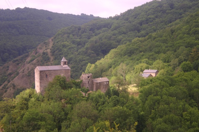
Hamlet of Blanc
In my last post, I speculated that İstanbul was a good candidate for the center of the world.
But now, I’m sitting in İstanbul’s antithesis, the hamlet of Blanc sur Sanctus, France, wondering whether the center might instead be here. Where İstanbul is large and hyperactive, Blanc barely hangs on and wonders about its future.
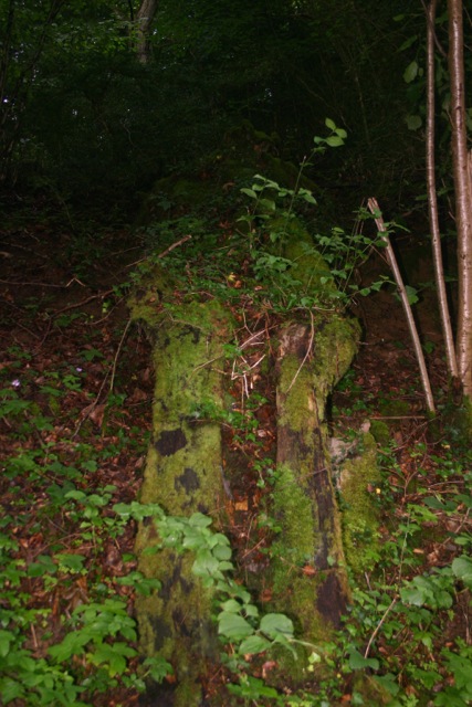
Moss near Blanc
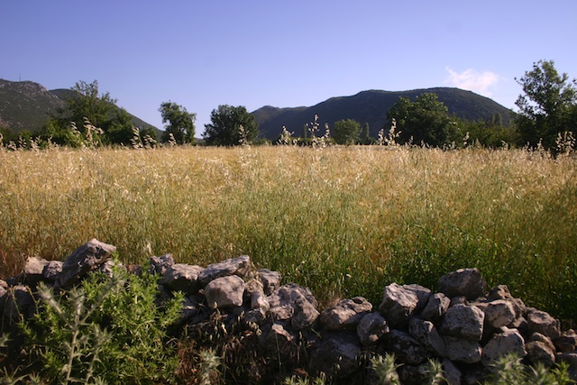
Blanc sits above the valley of the river Sanctus, whose early traces form a boundary between departments of Aveyron and Tarn. It’s in the Langedoc region, where names still resonate in Occitan. It’s also in the Parc naturel régional des Grands Causses, a lush region of limestone plateaus, cascading mountain streams, beech and pine forests, and family-scale agriculture.
Blanc was settled at least a millennium ago. A chateau was built in the 10th C. The place changed over the years, growing and prospering, especially in the 17th C. But by the mid 19th C, there were only 54 inhabitants, and the last two left in 1960. The combination of a the general rural exodus and WWI were too much for it. Today, it and its environs are protected by an association, Sauvegarde du Rouergue, and by two men who operate a set of guesthouses on the site.

Forest primeval?
We’re staying in what used to be the school and post office. It’s restored to protect it and to provide modern conveniences, but with the perfect weather we had, we could have lived outdoors.
Some would say that Blanc represents well the past for France, and the world. Small-scale agriculture is uncompetitive and too difficult. People are drawn to the cities–the good jobs, shopping, culture and night life, automobiles, new technologies and modern conveniences. Wherever the center may be, it certainly can’t be in Blanc.
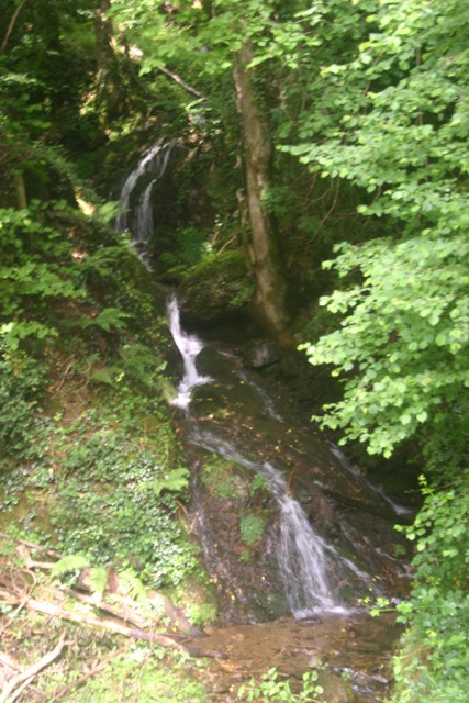
Cascades
And yet, in Blanc you can take long walks through forests and meadows to reconnect with nature and your own body. You can drink pure water from mountain streams. You can feel how rocks were carried to form walls and houses, rather than to read about them or see them in a museum. You can understand how water and topography have always shaped human lives and continue to this day.

Enfant Sauvage
Moreover, you can see that the life in Blanc is not so different from that in similar places in Turkey, the US, China, or elsewhere in the world. Few people would choose to re-enter that rural lifestyle, but many people seek the kind of peace and wholeness that it promises. There’s a solidity to life here that is more than merely the fact everything seems to be built out of rock. Nearby, the “wild child” of Aveyron perplexed early 19th C villagers with his back to nature existence.
Blanc affords an opportunity to find one’s individual center in a way that the intensely social world of İstanbul does not.
Center of the World

Milyon column, İstanbul
The Milyon column in İstanbul (left) is one of many “centers of the world.” These centers seem to be everywhere, each signifying by its presence the yearning for a stable ground, but by their proliferation, undermining any notion of centeredness.
The column is all that’s left of a monument that was the starting point for measurement of distances for all the roads leading to the cities of the Byzantine Empire. It lasted for over a thousand years, but disappeared at the start of the 16th C. During modern excavations, some partial fragments of it were discovered and erected again.
It served the same function as the Miliarium Aureum of Rome, another center of the world, which was displaced when Emperor Constantine I the Great remade Byzantium into his new imperial capital.

Directions to the world
Today, the Milyon column stands near the Basilica cistern, another ancient monument, which was covered up, then rediscovered in the 16th C. The cistern is a huge underground room to hold water. It’s 453′ x 212′, which is larger than a World Cup field, if you’d like a topical comparison.
It was built in the 6th C during the reign of the Byzantine Emperor Justinian I. During his era, and for centuries to follow, the cistern held fresh water for the citizens of Constantinople and the Milyon dome resting on four pylons marked the center of their world. As you explore the cistern’s eerily lit walkways, it’s easy to imagine that you’re in some mystical center of the earth.
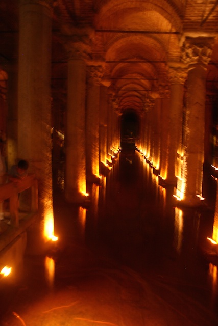
Basilica cistern, İstanbul
The cistern was unknown in the Western world until P. Gyllius discovered it while doing research on İstanbul’s Byzantine remains. He was surprised to see people getting water with buckets from well holes, some within their own homes, and even catching fish.
There are many more such “centers” (click here).
Some manage to calculate the geographic center as being the same location as the Geza pyramid, which would be a coincidence supporting many mystical accounts. But more commonly, it’s calculated as being in the eastern Mediterranean Sea about halfway between Athens and Alexandria. Other methods locate it in north-east Turkey.
In either case, I like the way that it’s not too far from İstanbul. That fabulous city straddles Europe and Asia, and through its ports and the Bosporos serves as a bridge to Africa. Its layers of civilization locate it between old and new, encompassing many religious traditions. If you had to choose one center, İstanbul and its Milyon column wouldn’t be a bad choice.
Ottoman fortification

Theodosian Walls at the Selymbria Gate, showing outer walls, inner walls, & moat wall
Last Monday I walked along the Walls of Constantinople, then returned along the Sea of Marmara. It was a beautiful day, with great views in every direction.
The stone walls were built in 324–336 to protect the city of Constantinople (née Byzantium) after its founding as the new capital of the Roman Empire by Constantine the Great. It was the last and one of the most complex fortification systems built in antiquity. Gunpowder began their demise, but it was the large number of Ottoman invaders that caused the city to fall to a siege on May 29, 1453.

Mihrimah Sultan Camii
Nevertheless, the walls had protected the city for over 1100 years, making them the most successful ever built. Even after the fall of Constantinople, Ottomans under Sultan Mehmed II added to the fortifications by building the Yedikule Hisari (Seven Towers Fortress) at the Golden Gate.
The walls have suffered from wars, earthquakes, and urban development, but still stand as an impressive monument and a marker of inner and outer İstanbul. Restoration began in the 1980s.
It’s not possible to walk on top of the walls the entire 4.5 km length. There are heavily damaged sections and major roads now pass through most of the original gates. Several times I climbed up steep stone stairs overgrown with weeds and broken in many places. I’d walk a while, then find that I needed to retrace my steps. At other times, I had to walk away from the wall to circle through some neighborhood before returning to it. As a consequence, I had to walk at least twice the length of the wall itself.

Ottoman Empire, 1683
The route is part of the Sultan’s Trail, a project to build a long-distance path from Vienna to İstanbul. That project appears stalled, but you can still see blazes for it. You can also see many aspects of İstanbul: beautiful vistas and trash piles, new and ancient constructions, carefully planned development and urban sprawl. In Turkish, I’d say güzel ve çirkin, yeni ve eski, iyi ve kötü.
There are many interesting sights along the wall. My favorite is the Mihrimah Sultan Camii (mosque) at Edirnekapı (the Edirne Gate). It was designed by Mimar Sinan (“Sinan the Architect”) for the favorite daughter of Suleiman the Magnificent, Princess Mihrimah. It’s filled with light due to the extraordinary number of windows, a speciality of Sinan’s. Although it’s a large cami, it has only one minaret, symbolizing the loneliness of Mihrimah and Sinan due to their forbidden love. Edirnekapı itself is where Sultan Mehmed II entered the city after its defeat in 1453.
Ottoman furniture today
As I walked, I imagined what it would take to make something like the Promenade Plantée in Paris or the High Line in New York City. With some repairs to the wall, a little new construction, and handrails for people like me, İstanbul could have the best of these new urban walkways.
Walking back through a park along the Sea of Marmara made this into a strenuous, but rewarding day. I was personally fortified with a tradtional Ottoman dinner in the Sultanahmet area at Pasazade and appreciated the Ottoman-style furniture in our hotel. The day after, we ate at Asitane, which claims to have done six months of research on the details of fine Ottoman court cuisine in order to recreate that food culture.
The Way of the Lycians

Our neighbor
If I could rank civilizations in terms of how important and interesting they are divided by how much I know about them, Lycia would be near the top. Of course, that works only if I leave out the many I know nothing about.
Lycia is a region along Turkey’s Mediterranean coast between Antalya and Koycegiz. Its rivers, including Xanthos and Alakir drain the Anatolian plateau and are among the largest in the country. The entire region is mountainous, with some peaks rising over 10,000 feet. The mountain ranges encroach on the sea, pausing only enough to allow for beautiful beaches.
Barley in the Bezirgan yayla
Our B&B is in a yayla (summer pasture) about 3000 feet above the sea. Nearby, the Kaputaş beach provides a good example of the topography.
It’s at the base of Kaputaş canyon, a narrow cleft at the foot of the Taurus mountains. The beach is 200′ wide and 70′ deep, with a scarp rising 80′ straight up behind. You can reach the beach by boat or by a staircase with 187 steps (seemed like more to me). Off its eastern end the sea has eroded the Blue Cave, nearly 200′ across, and a favorite of small tour boats and inner tube riders.

Kapitaş beach at the base of the canyon
The Lycian civilization developed within this region. They probably came from Crete around 1400 BC. They had their own language and unique script, still not fully understood. They had unique customs and funerary architecture.
Even though they lived in mountainous terrain with seemingly inaccessible villages, the Lycians formed a union while the rest of the Greek world was warring city states. They had representative government when Greek cities still had rule of the whole body of citizens. In the later Lycian League, they had a bicameral legislature, panels of judges, and other complex civic structures.
Lycians used matrilineal lineage: People identify themselves by their mother and their mother’s mother, not the father. Moreover, offspring of a Lycian woman are automatically legitimate, whereas those born to a Lycian man and a foreigner are illegitimate. Herodotus thought that this was unique, but many other cultures employ a similar system. Our B&B host cites it as evidence that the Celts derive from Lycia.

Xanthos
The Lycians resisted domination, being the last in Asia Minor to become a province of the Roman empire. They won some of their battles, either by force or diplomacy, but the losses were dramatic and tragic.
In 540 BC, the Persian commander Harpagos attacked Xanthos, the largest and most prominent city. Finally succumbing to a blockade, the Xanthians gathered all the women, children, slaves, and household goods and set fire to them, then fought on until every Xanthian had been killed or committed suicide. Every item of value had thus been destroyed. Later, 80 Xanthian families who had been elsewhere during the fighting returned and rebuilt the city. The poem below, found at the Xanthos site, describes this event:
We made our houses graves
And our graves are homes to us
Our houses burned down
And our graves were looted
We climbed to the summits
We went deep into the earth
We were drenched in water
They came and got us
They burned and destroyed us
They plundered us
And we,
For the sake of our mothers,
Our women,
And for the sake of our dead,
And we,
In the name of our honor,
And our freedom,
We, the people of this land,
Who sought mass suicide
We left a fire behind us,
Never to die out…Poem found on a tablet in the Xanthos excavations, translated by Azra Erhat
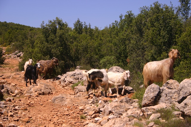
Keçiler (goats) on Lycian Way
This scene was repeated when Brutus sacked the city in 42 BC. He offered a reward to any Roman soldier who could save a Xanthosian by preventing his suicide. But only 150 survived.
Despite these tragedies, in most cases the Xanthians succeeded against plunderers, until their artifacts were finally conquered by the British Museum in 1838.
Much evidence of the Lycian civilization still remains, as do, I suppose, descendants of those early peoples. The 300 mile long Lycian Way, which runs through our village, near Kaputaş beach and Xanthos, is Turkey’s first long-distance, waymarked path. Along the way one can see endless structures from the Lycian era and imagine its history stretching back 3400 years.
Kemal Hakki Tor’s Lycia is a good introduction to the area.
The Black Citadel of Opium

Afyon citadel
Afyonkarahisar (Turkey) is a cool name for a town.
To start, it’s seven syllables. How many towns can claim that? In the US, Philadelphia has five, Indianapolis has six. The full name for Llanfairpwllgwyngyll (Wales) has around 15 syllables, and there’s a town in Thailand with even more. However, among towns that people regularly say and name on signs, Afyonkarahisar must be in a select group.
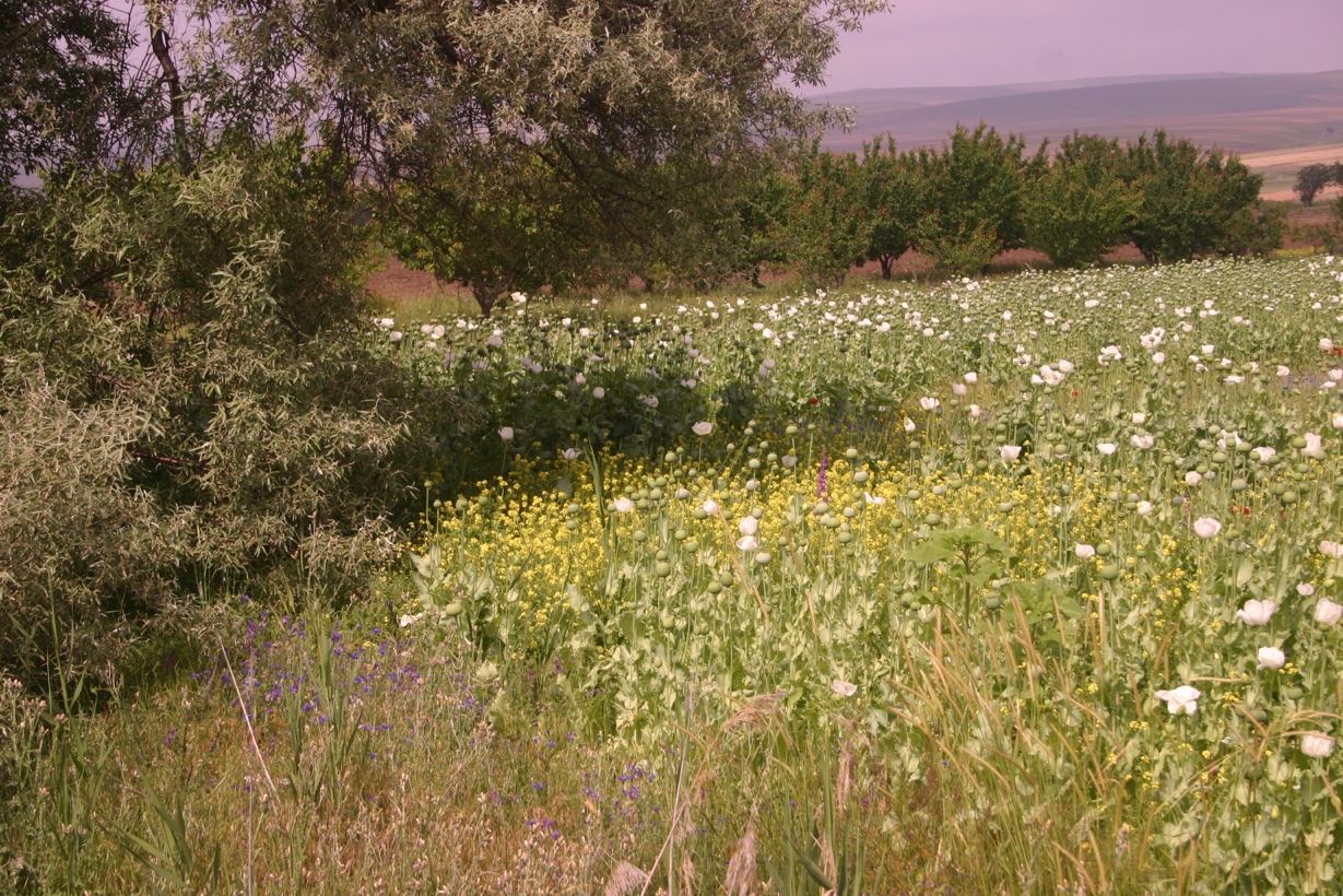
Poppies (Papaver somniferum)
The meaning of Afyonkarahisar is striking, too. “Hisar” means citadel or fortress, and refers to the stunning rock/castle in the center. It’s 570 steps up, which should convey a sense of its height.
“Kara” means black and “Afyon” means opium, which is widely grown in the area. So, Afyonkarahisar is the Black Citadel of Opium.

Ottoman era houses
You can see poppy growing in many places around Afyonkarahisar. This is essential for one of the regional specialities, Kaymak, a creamy dairy product, made from the milk of water buffalos. The water buffalo are fed the residue of poppy seeds (haşhaş) after it has been pressed for oil. Kaymak is often traditionally eaten with honey as a supplement to breakfast.
Opium seed paste
Haşhaş (or opium seed paste) itself is sometimes served at breakfast. I learned that it is given to children to calm their stomachs and to help them sleep through the night (hush-hush?). Since my own stomach has been queasy lately, I’m hoping a generous serving will benefit me as well.
Down at the bottom of the citadel is an old town, with many houses from the Ottoman era. We stayed in one that’s been converted into a charming hotel: Şehitoğlu Konaği. Other than bumping my head, which seems to be a problem everywhere I go, I enjoyed the step into the past, with elaborate woodwork, long sofas, and many pots, pitchers, and plates made of copper or silver.
Andrea Bianco

Zhong He’s map, 1418
I’ve always been interested in maps, and that interest has grown rather than diminished as I began to learn about them as rhetorical devices. Mark Monmonier discusses this in his How to Lie with Maps.
As faithful representations of reality, maps are endlessly fascinating and useful as tools for many purposes, not just finding one’s way. But as constructed artifacts, they embody a mix of physical reality and human passion––becoming devices for power, greed, delusion, hope, art, and more.
Recently, I read The Mapmaker: A Novel of a Great Navigator who sailed Fifty Years Before Columbus by Frank G. Slaughter. It’s a fictionalized account of Bianco’s life, but one done with an attempt to represent accurately what is known about Bianco, while filling in the gaps with a plausible story.
Portugal’s ruler Prince Henry the Navigator, sent various expeditions into the western Atlantic and along the African coast, beginning in 1418. These voyages were secret. There was a real interest in adding to the knowledge of the world, but that was coupled with a desire to use that knowledge for private gain. Not all of the discoveries were shown on published maps, and some were designed to mislead commercial rivals by concealing the existence of new lands and resources.
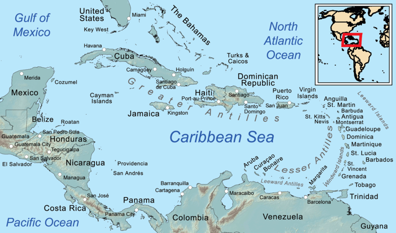
Antilles within the Caribbean
The Portuguese had probably reached the Antilles archilpelago at the Eastern edge of the Caribbean by 1430. Between 1436 and 1448, Andrea Bianco made, but did not publish, maps showing the locations of Newfoundland, Florida, and Brazil. Later Portuguese maps, published in 1459 and 1489, show Asia with something like Florida, conveniently omit South America.
Bianco developed the “Tondo e Quadro” (“circle and square”) method for seeing and measuring a return course. This was invaluable for repeat voyages to secure foreign resources. He collaborated with Fra Mauro, who made other detailed world maps and estimated the world’s circumference within 10% of modern figures. See The Ancient Americas: Migrations, Contacts, and Atlantis, by David Pratt.
Prior to the Portuguese voyages, the famous Chinese admiral Zheng He (a Muslim) had circumnavigated the earth. A world map was published in China during the Ming dynasty in 1418. It shows that the Ming navy had a rough knowledge of Baja California, the west coast of South America, as well as Labrador, Florida, and the Gulf of Mexico. The Chinese maps probably contributed to the Europeans’ knowledge.
The Europeans also learned from Arab science and technology. Arabs put south at the top of maps. When you face the sun in the morning, south is on the right, and right has positive associations. Also, with the sea to the south their land was then on the top of the map. Europeans flipped the map to put north and themselves on top.

Andrea Bianco, explorer and mapmaker
To me, this all suggests that what I had learned about voyages of discovery was mostly wrong, and much less interesting than the fuller, more objective accounts available today. School textbooks tended to minimize or omit entirely any non-European contribution. That left out crucial parts of the story, including the cultural aspects of geography.
The textbooks also represented the discovery era as one of courageous, individualized pursuit of knowledge. Instead, the voyages were an essential aspect of empire building based on already extensive knowledge. Rather than enlightening an ignorant world, they were used to acquire knowledge, then deliberately mislead competitors.
