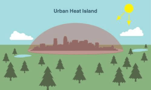
An illustration of an urban heat island.
NASA/JPL-Caltech
Jasna Budhathoki and Jenish Budhathoki, a sister-brother team, have completed an award-winning AI / machine learning project that promises to save lives. The Heat-Sccape: Mapping Urban Heat from Space project uses satellite imagery to measure land surface temperatures at the neighborhood level and identify urban areas most vulnerable to extreme heat. It combines physics-based modeling with machine learning.
The need
There are up to 12,000 heat-related deaths each year in the U.S. alone. In most counties communities of color experience significantly higher surface temperatures than white, wealthier neighborhoods. Those areas can be up to 7 ℉ warmer.
Heat-Sccape uses high-resolution land surface temperature (LST) maps to identify the hottest neighborhoods. Those are overlaid with income and demographic data. This enables directing cooling resources to areas with the greatest need. Those resources could include urban greening, cool roofs, or hydration stations.
In terms of climate resilience, the project can track surface temperature trends, measure whether mitigation investments are working, and forecast heat risk. Results can be available within minutes of satellite overpass, leading to alerts when heat thresholds are exceeded, with risk summaries downlinked directly to city systems.
See more about the project including technical details.
Work on the project (from Jenish)
In the qualifying round, we used a neural network to process satellite images and mark every pixel that was a building or paved surface. We trained the network on 27,000 labeled images, letting it guess, measure how wrong it was, and adjust itself millions of times.
Our final round task was to turn a satellite’s raw heat readings into ground temperatures, accurate to about a degree. There were two main issues we encountered for this task: first, the heat signal has to cross the whole atmosphere to reach the satellite, and water vapour absorbs some of it in transit, so every surface reads colder than it really is. And second, materials differ in how efficiently they emit heat. A metal roof and a patch of grass at exactly the same temperature send out different amounts of infrared, so the satellite reads them as different temperatures when they are not. We corrected the first using the fact that water vapour interferes unevenly across wavelengths, so the difference between two detectors reveals how much interference there was, and the second by looking up NASA’s measured emissivity at each exact coordinate. Because we only had 574 labelled examples which is not enough for a large model, we used physics for retrieval and used a small machine learning model to remove the leftover error. That finished ninth internationally with a bronze medal.
Bronze award
The team won a Bronze Medal at the AI and Space Computing Challenge 2026, a global competition held under the United Nations’ “AI for Good” initiative, placing seventh worldwide in the “Space Intelligence for Resilient Cities” track. Jenish led the team through both rounds, from the initial proposal to the final submission, The team is now expanding the project to many other US cities.
From a MyRepublica article:
“I had already spent a lot of time working with climate data at Duke, so when I came across this challenge, I knew exactly what kind of problem I wanted to solve,” Jenish said. “Leading a team was intimidating at first, but once we had a clear plan, it became more about doing the work. I learned as much from this project as I have from any class.”
Jasna said the project involved “a lot of late nights” alongside her work but was especially rewarding because she got to build something with her brother and watch him lead the project.
The team completed the project, shortly after Jenish graduated from high school and before starting college at Macalester. During his gap year, he gained research experience working with climate datasets at Duke University. Jasna developed the machine-learning model used to refine the team’s temperature predictions. She is a software development engineer at Amazon with a recent MS in Computer Science with a specialization in Machine Learning from Columbia University.