
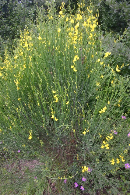
Broom and petunias
Observing the world while walking is paradoxical. It’s slower even than riding a bicycle or a horse, so the total distance covered seems puny. There’s little chance to see a Michelin *** “worth the trip,” a ** “worth a detour,” or even a * “of interest.” If you were to see a Michelin *, there would most likely be just one in several days of walking.
Yet I find that when I travel fast just to see a *, it often fails to live up to its rank. It’s often overrated, overly crowded, or less accessible than I imagined. But beyond that, if I got there in a blur, I don’t have a sense of what it means to be that * in just that place or how it relates to the things around it. But those relations are usually part of what gives it * status––the most of this or the best of that.
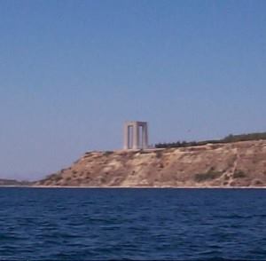
Çanakkale Martyrs’ Memorial
In contrast, when I walk I have plenty of time to observe and to think about what I see. Just this week, we walked from ÇOMU Dardanos, through Dardanos Village, past Kepez Limani, to Kepez center. The place names aren’t important if you don’t know the area. What’s worth noting is that this was a distance of over five miles each way, following the coastline. We could look at the hillsides to the east and across the Dardanelles to the Gallipoli peninsula to the west. With some stops and detours, plus lunch in Kepez, the return trip consumed much of the day.
Walking along the Dardanelles in this way we observed the bustling ship traffic. Some carried Russian oil from the Black Sea, traversing the Bosporous, the Sea of Marmara, the Dardanelles, then into the Aegean Sea and the Mediterranean. Some northbound traffic contained goods from China bound for İstanbul, then on to various destinations in Europe. There are weapons, radioactive materials, household items, clothes, industrial equipment, paper items, and who knows what else, probably 60,000 ships a year. Most of what I see is ships with cargoes mysterious to me, though I could spin fanciful tales about their purposes.

Fishing
The bumper to bumper and two-way ship traffic and uncertain current makes it a difficult and dangerous waterway. Pilots must slow down and speed up their engines to maintain the 15 knot speed limit. Nevertheless, in 2005 over 55,000 ships, including almost 6,000 oil tankers passed through Marmara, most carrying Russian oil. (By the way, “bumper to bumper” may not be the correct nautical terminology.)
As I observed the straits on this and other walks, including a long one to Güzelyalı, I became intrigued by the shape of the straits and what that meant both for walking and shipping. I could see about a third of its length, from the Aegean Sea, where ships waited their turn to enter all the way to Çanakkale, where there’s a 90˚ turn at the narrowest point.
The narrowing and widening, the shape of the bays, and the strong prevailing winds off the water define the character of the walking, just as they constrain the ship traffic. The visibility changes with the winds; a good indicator being the Çanakkale Martyrs’ Memorial at the tip of Gallipoli. It’s clearly visible and sharp, with the Turkish flag flying above when the air is clear.
The walking and leisurely viewing made me think about the geography I was experiencing and want to read more about it. Gazing across to the Gallipoli peninsula, I couldn’t help being aware that I was in Asia, looking at Europe. About 50 miles to the south, is Cape Baba, in Babakale (Papa’s Castle), the westernmost point of Asia.
One could have these thoughts while riding in a car or sitting in an armchair at home. But I find that being outdoors, seeing the details of the landscape, and feeling the effects of sun, wind, tide, and time, I become more directly connected to the world and learn geography in a way I could never do with a map or book alone, and absolutely not while locked into a faster mode of transit.
To be continued…
