New FEMA flood maps are full of errors

In 2004, the Federal Emergency Management Agency began a $200 million/year flood map project using mapping technology (GIS/GPS) to identify areas susceptible to flooding. The goal was to mitigate future catastrophes like the flood in Iowa, which caused $10 billion of damage.

But critics, including civic leaders, developers and home owners in several states, have complained that the new maps are riddled with inaccuracies, seem arbitrarily drawn, and will stifle growth and hurt property values…Doug Boyer, whose home would be in the flood plain for the first time if FEMA’s Oakville map gains final approval, said it’s inexplicable why FEMA extended the flood plain border to the center of Main Street in the relatively flat town. “The east side is in the flood plain and the west side is fine — it’s odd that the water will stop at Main Street.” FEMA flood maps are full of errors, cities say

Property owners naturally have a vested interest in what the new maps say. Nevertheless, it’s easy to sympathize with Boyers wonderment at why the water would stop at Main Street. This seems like a good argument for the incorporation of user-generated content in the production of maps, or what’s called Volunteered Geographic Information, as in a forthcoming issue of Geomatica.

US halts airlift of Haiti quake victims

Many people have responded to the earthquake tragedy in Haiti with money, volunteer work, and basic sympathy and care. Nevertheless, it’s disturbing to see the ways in which we fall short. It’s hard for me to imagine that the recent suspension of medical evacuations would have occurred for a disaster in say, Canada or Europe.

The United States has suspended its medical evacuations of critically injured Haitian earthquake victims until a dispute over who will pay for their care is settled, military officials said Friday.

The military flights, usually C-130s carrying Haitians with spinal cord injuries, burns and other serious wounds, ended on Wednesday after Gov. Charlie Crist of Florida formally asked the federal government to shoulder some of the cost of the care.

Hospitals in Florida have treated more than 500 earthquake victims so far, the military said, including an infant who was pulled out of the rubble with a fractured skull and ribs…The suspension could be catastrophic for patients, said Dr. Barth A. Green, the co-founder of Project Medishare for Haiti…“People are dying in Haiti because they can’t get out.”

via In Cost Dispute, U.S. Halts Airlift of Haiti Quake Victims – NYTimes.com.

Who’s responsible for the fragility of Haiti?

In What You’re Not Hearing about Haiti (But Should Be) at CommonDreams.orgCarl Lindskoog presents an excellent account of why the disaster in Haiti is neither entirely a natural one nor the fault of the Haitian people and government:

[January 14, 2010] In the hours following Haiti’s devastating earthquake, CNN, the New York Times and other major news sources adopted a common interpretation for the severe destruction: the 7.0 earthquake was so devastating because it struck an urban area that was extremely over-populated and extremely poor.  Houses “built on top of each other” and constructed by the poor people themselves made for a fragile city.  And the country’s many years of underdevelopment and political turmoil made the Haitian government ill-prepared to respond to such a disaster…

It may startle news-hungry Americans to learn that these conditions the American media correctly attributes to magnifying the impact of this tremendous disaster were largely the product of American policies and an American-led development model.

Lindskoog shows how USAID policies led to structural changes in the countryside, which predictably forced Haitian peasants who could no longer survive to migrate to the cities, especially Port-au-Prince. Promised manufacturing jobs failed to materialize.  Port-au-Prince became overpopulated and slum areas expanded.  Poorly constructed housing followed and the eventual abandonment of the US-led development model. Haitians, with virtually no financial resources were left to address the problems they had not created.

Devastation in Haiti

Last April I wrote, Friends don’t let friends suffer: The US must step up for Haiti, about the responsibility of everyone, but especially those in the US, to do more for Haiti. The argument for doing so is compelling on many grounds. It calls for a long-term commitment to rebuilding the Haitian economy and to changing the relationship between Haiti and its wealthy neighbors.

Now, the devastating earthquake that struck Haiti on Wednesday, with aftershocks continuing, needs immediate attention. In addition to making our government do more, we can work through NGO’s (see How to Help at NPR). Beyond that, Haitians should be immediately granted Temporary Protected Status (TPS). The Department of Homeland Security review and revise US policy towards Haiti.

If anything good can come from this disaster, it might be that we begin to act in a more humane and responsible way toward one of our closest neighbors. Beyond immediate needs there must be concerted action to address the underlying economic and political catastrophe that afflicted Haiti even before the earthquake.

In that earlier post, I listed six specific actions that the US and international agencies could do now.

Quetico, August 1963

Here are some photos from my trip to Quetico Provincial Park in August 1963. Notice the water damage on the 35mm slides, which is explained by the story that follows the photos.


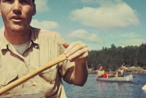
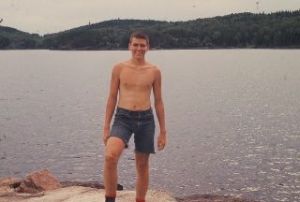
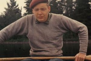
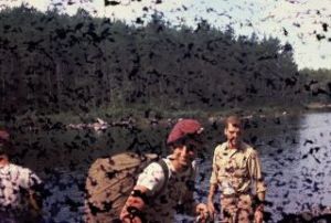
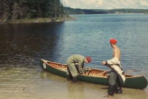
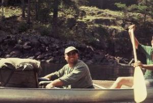
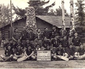
In August of 1963, our Explorer Post 52 traveled to Ontario’s Quetico Provincial Park just west of Lake Superior on the Canada-U.S. border for a wilderness canoe trip. In order to get to Quetico, we journeyed for three days from Fort Worth in what was even then an old, yellow school bus. We stayed in Air Force bases, sleeping on the gym floors and experiencing steam baths for the first time.

This was a year of changes, including the arrival of the Beatles in the US and the assassination of President Kennedy. But the trip was the major event in my life that year.

It was a wonderful trip in many ways. We stayed up most of one night watching a rare display of the Aurora Borealis, which filled the sky for hours. The sun was shining, the fishing was good, and there was great singing, story-telling, and endless argument about the meaning of life around the campfires. It was good exercise, too, especially with the canvas packs of those days. On portages, one of us would carry the canoe, one a food pack, which weighed 110 pounds in the beginning, and one all our gear–cotton sleeping bags, canvas tent, and clothes.

The Storm

We had been out for at least a week when the storm came up. It was on the Basswood River, but in a wide section, like a long lake. When the storm arrived, we decided not to risk a crossing and pulled into a cave a the base of a huge granite cliff with pictographs. “Picture rock” on Crooked Lake was shown in the September 1963 National Geographic, and I recall seeing the Basswood cliff when I returned from the trip.

I held my canoe onto the rock under this 100-foot cliff, as did Fred Moyer, our guide. The other two canoes held on to us, locked together to avoid capsizing.

After a few minutes, I released my grip on the rock for just a moment to tighten my poncho. As I did, lightning struck a solitary tree at the top of the cliff. The current traveled down the cliff to our cave. Everything went suddenly white, for some indefinite period. If you told me today that it was ten seconds or just one, I wouldn’t be able to dispute it, because time didn’t exist for me then. I could feel the charge in the air, and am still sensitive to changing electrical conditions. When I’ve felt that while canoeing, I get very nervous.

The current reached Fred’s hand, which was still touching the rock. His canoe, which was the only wood and canvas one, was shattered. Bob Cocanower and Gary Rall were the two scouts in Fred’s canoe and they both suffered physical injury from the lightning: Bob’s arms were paralyzed and Gary’s legs. Fred was killed instantly.

After Fred died, Chuck Borgeson and Duane, the guide from a companion group, took his body to the ranger station (see Bobby’s account, too). I must have gone into shock, because I went to sleep later that morning and slept until the next day. We, of course, cut the trip a short from what was planned originally, but not by much, because there wasn’t an easy way just to exit from such a remote location.

Aftermath

The accident was reported in Texas newspapers as “lightning strikes Scout group, at least one killed.” Naturally, our parents were distraught, but unable to learn much about what had happened for several days. This was well before cell phones and we had no portable radio.

It’s sobering to realize that I was the only one other than Fred holding on to the rock just before the lightning struck. If I hadn’t let go to pull my poncho, all 12 of us might have died, because it would have completed an electrical circuit connecting all our aluminum canoes.

We managed to complete the trip without further mishap, but aspects of it are still vivid for me today. After the wilderness experience, we went to Winnipeg and found a restaurant that offered all-you-can-eat lunches for 49 cents. After two weeks of vigorous exercise and eating our own cooking of dehydrated potatoes, we were hungry beyond any measure a restaurant should have to endure. It wouldn’t surprise me to hear that we put them out of business.

References

Coalson, Bob. The Fred Moyer incident. Post 52 history: Charles L. Sommers Canoe Base.

Olson, Sigurd F. (1963, September). Relics from the rapids. National Geographic, 124(3), 412-435.